Kempsville in Virginia Beach, Virginia — The American South (Mid-Atlantic)
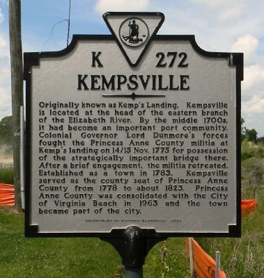
Kempsville
Erected 2002 by Department of Historic Resources. (Marker Number K-272.)
Topics and series. This historical marker is listed in these topic lists: Political Subdivisions • Settlements & Settlers • War, US Revolutionary. In addition, it is included in the Virginia Department of Historic Resources (DHR) series list. A significant historical date for this entry is October 7, 1775.
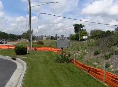
Location. 36° 49.624′ N, 76° 9.783′ W. Marker is in Virginia Beach, Virginia. It is in Kempsville. Marker is on Princess Anne (Access) Road, 0.1 miles east of Princess Anne Road (Virginia Route 165), on the right when traveling east. Emmanuel Episcopal Church. Touch for map. Marker is at or near this postal address: 5181 Princess Anne Road, Virginia Beach VA 23462, United States of America. Touch for directions.
Other nearby markers. At least 8 other markers are within 2 miles of this marker, measured as the crow flies. Princess Anne County Courthouse (within shouting distance of this marker); The Skirmish Of Kempsville (about 300 feet away, measured in a direct line); Skirmish at Kemp’s Landing (about 700 feet away); Filipinos in the U.S. Navy (approx. 0.8 miles away); Filipino American Veterans of Hampton Roads (approx. 0.9 miles away); Filipino American Sea Service Veterans (approx. 0.9 miles away); Princess Anne County Training School / Union Kempsville High School (approx. 1.1 miles away); New Town (approx. 1.7 miles away). Touch for a list and map of all markers in Virginia Beach.
Regarding Kempsville.
Also see . . . Historic Kempsville :: Official City of Virginia Beach Web Site. (Submitted on May 22, 2014, by PaulwC3 of Northern, Virginia.)
Credits. This page was last revised on February 1, 2023. It was originally submitted on May 22, 2014, by PaulwC3 of Northern, Virginia. This page has been viewed 1,319 times since then and 104 times this year. Photos: 1, 2. submitted on May 22, 2014, by PaulwC3 of Northern, Virginia.

