Wilson in Niagara County, New York — The American Northeast (Mid-Atlantic)
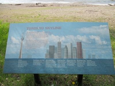
Toronto Skyline
On a clear day it is possible to see Toronto across the lake. Toronto, originally called York, was founded in 1793 as a defense post to guard against the threat of United States invasions. York was incorporated as the city of Toronto in 1834. The Industrial Revolution of the 19th century and immigration after 1945 caused the city to grow tremendously. Toronto, with over 2.5 million residents, is a culturally diverse city with a prosperous economy.
CN Tower This 1,815-foot tall building is the signature piece of Toronto's skyline. Since 1976, Canada's National Tower has been the world's tallest self-supporting structure. In 2006, at 1,465 feet, the tower's Space Deck was the world's highest observation deck.
Toronto Dominion Bank Tower This 731-foot-tall, 56 story building, completed in 1967, was designed by noted architect Ludwig Mies Van Der Rohe. It was Canada's tallest building until the CN Tower was constructed.
First Canadian Place This 978-foot-tall, 72-story building, has been Canada's tallest office building since 1975. First Canadian Place has the tallest sign in the world, The Montreal Bank logo, but lost that distinction in 1997. Over 10,000 people work in the building and more than 16 million visit it each year.
Canada Trust Tower This 856-foot-tall, 53-story building is one of the most distinct in Toronto's skyine. Completed in 1990, the building's lobby is connected to a glass galleria designed by world-renowned Spanish architect Santiago Calatrava.
Commerce Court West Completed in 1972, this 784-foot 54-story building with its stainless steel exterior was designed by I. M. Pei, one of the 20th century's most successful architects.
Bay Wellington Tower Completed in 1991, this 679-foot, 49-story building has totally column-free office floors. The square surfaces of the tower make it appear as two, depending on your view.
Scotia Plaza This 902-foot-tall building was completed in 1988. The unique V-shaped design emphasizes the building's top floors. Over 8,000 people work in this 68-story building.
Topics. This historical marker is listed in this topic list: Landmarks. A significant historical year for this entry is 1793.
Location. 43° 18.675′ N, 78° 51.21′ W. Marker is in Wilson
Photographed By Anton Schwarzmueller, May 22, 2014
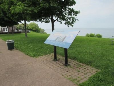
2. View of 12-Mile Creek and Toronto Skyline Marker
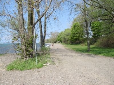
Marker is located at the junction of Twelve Mile Creek and Lake Ontario. Update 9/1/2020: Due to years of extremely high lake levels, the shore has eroded to within a few yards of the marker. Boulders have been installed, and the area between them and the marker has been graded.
Other nearby markers. At least 8 other markers are within walking distance of this marker. Welcome to Wilson-Tuscarora State Park (about 700 feet away, measured in a direct line); Beach Treasures (about 700 feet away); Lake Shore Rarities (about 700 feet away); O'Connell Island (approx. ¾ mile away); A Solemn Tribute to the Men and Women of Wilson who Served (approx. 0.9 miles away); Vietnam Memorial in Memory of 1st Lt. Michael E. Witkop (approx. 0.9 miles away); Lake Island Park (approx. 0.9 miles away); Lake Island Park, Wintergreen Island, Tugwell Island & Clark Island (approx. 0.9 miles away). Touch for a list and map of all markers in Wilson.
More about this marker. Wilson-Tuscarora State Park has an admissions booth. A fee may be collected for admission in season during business hours.
Also see . . .
1. CN Tower - Wikipedia. (Submitted on June 6, 2014, by Anton Schwarzmueller of Wilson, New York.)
2. Toronto Dominion Centre - Wikipedia. (Submitted on June 6, 2014, by Anton Schwarzmueller of Wilson, New York.)
3. Brookfiled Place - Wikipedia. TD Canada Trust Tower and Bay Wellington

Photographed By Anton Schwarzmueller, May 22, 2014
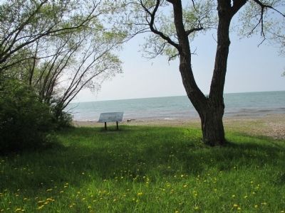
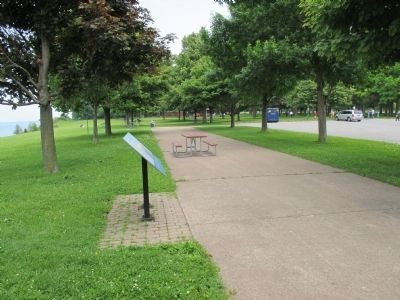
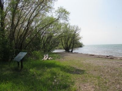
3. Opposite View Toronto Skyline Marker and Beach
Here is the view from the opposite side of the marker, looking east towards the beach at Wilson-Tuscarora State Park. Update 9/1/2020: The shoreline has eroded to about the mid-line of this image frame.
4. Commerce Court - Wikipedia. (Submitted on June 6, 2014, by Anton Schwarzmueller of Wilson, New York.)
5. Scotia Plaza - Wikipedia. (Submitted on June 6, 2014, by Anton Schwarzmueller of Wilson, New York.)
Photographed By Anton Schwarzmueller, May 22, 2014
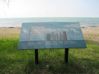
10. Toronto Skyline Marker and Horizon
When this picture was taken, the Toronto skyline could be seen by the naked eye in gray-blue outline on the horizon above the marker, but not by the camera. For a view as good as that depicted on the marker, ideal weather and binoculars or a similar optical tool are required.
Credits. This page was last revised on September 1, 2020. It was originally submitted on June 6, 2014, by Anton Schwarzmueller of Wilson, New York. This page has been viewed 986 times since then and 75 times this year. Photos: 1, 2, 3, 4, 5, 6, 7, 8, 9, 10. submitted on June 6, 2014, by Anton Schwarzmueller of Wilson, New York. 11, 12. submitted on June 22, 2014, by Anton Schwarzmueller of Wilson, New York. • Bill Pfingsten was the editor who published this page.
