Coopers Rock State Forest in Monongalia County, West Virginia — The American South (Appalachia)
Henry Clay Iron Furnace
Photographed by J. J. Prats, June 17, 2014
1. Henry Clay Iron Furnace Marker
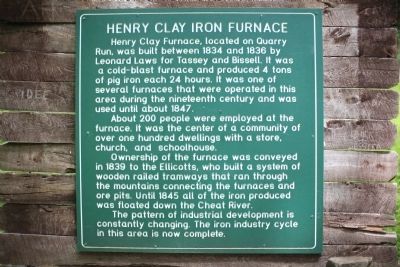
About 200 people were employed at the furnace. It was the center of a community of over one hundred dwellings with a store, church, and schoolhouse.
Ownership of the furnace was conveyed in 1839 to the Ellicotts, who built a system of wooden railed tramways that ran through the mountains connecting the furnaces and ore pits. Until 1845 all of the iron produced was floated down the Cheat River.
The pattern of industrial development is constantly changing. The iron industry cycle in this area is now complete.
Topics and series. This historical marker is listed in this topic list: Industry & Commerce. In
this page online
Location. 39° 38.939′ N, 79° 49.073′ W. Marker is in Coopers Rock State Forest, West Virginia, in Monongalia County. It is on County Line Drive (Local Route 73/12) south of Exit 15 (Interstate 68). Touch for map. Marker is at or near this postal address: 61 County Line Drive, Bruceton Mills WV 26525, United States of America. Touch for directions.

Regionally, this marker is in North Central West Virginia. It is also in the American South, specifically in the Upper South, in Appalachia, and specifically in Northern Appalachia. Globally, it is in North America, the Western Hemisphere, the Western World, and the Anglosphere. Historically, it finds itself in what was once the territory of the Mississippian Culture.
Other nearby markers. At least 8 other markers are within 3 miles of this marker, measured as the crow
Photographed by J. J. Prats, June 17, 2014
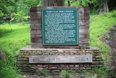
2. Henry Clay Iron Furnace Marker
Another marker is no longer nearby. Monongalia County / Preston County (was approx. 1.9 miles away but has been confirmed missing).
More about this marker. This marker is at the end of a one mile downhill hiking trail, the Clay Furnace Trail, blazed red and described as moderate in difficulty. It is fairly level with some steep sections. It begins at the furnace parking area in Coopers Rock State Park
Photographed by J. J. Prats, June 17, 2014
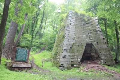
3. Henry Clay Iron Furnace and Marker
Regarding Henry Clay Iron Furnace. The wagons on the wooden tramways were hauled by oxen. Pig iron and finished goods were transported to Jackson’s Iron Works near Ice’s Ferry on the Cheat River where a sawmill made barrels and flat boats that floated the goods to market on the Monongahela and some as far as the Ohio and Mississippi. The boats were sold for lumber at the destination and the crew walked back to Ice’s Ferry.
After 1849 the industry declined rapidly. The last iron was made at Ice’s Ferry in 1868. —Source: A very thorough and readable pamphlet by Ben White and Kenneth Carvell available at no charge at the Coopers Rock State Park concession building.
Related marker. Click here for another marker that is related to this marker.
Also see . . . Henry Clay Furnace. Wikipedia entry:
“Henry
Photographed by J. J. Prats, June 17, 2014
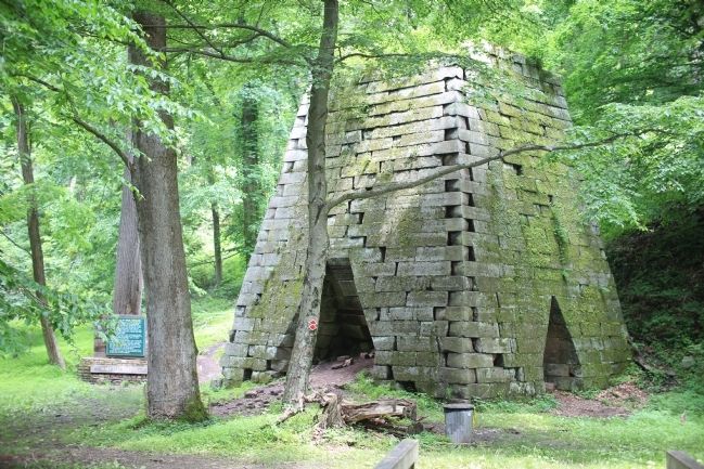
4. Henry Clay Iron Furnace
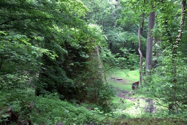
Photographed by J. J. Prats, June 17, 2014
5. First View of the Furnace from the Trail
The trail continues to the left, curving around to the front of the furnace as it finishes its drop to the valley floor. You can scramble down this shortcut if you would like. It was from this elevated path that a wooden bridge to the top of the structure was used to introduce the iron ore, lime, and charcoal into the furnace.
Credits. This page was last revised on August 20, 2025. It was originally submitted on June 17, 2014, by J. J. Prats of Powell, Ohio. This page has been viewed 1,685 times since then and 65 times this year. Photos: 1, 2, 3, 4, 5. submitted on June 17, 2014, by J. J. Prats of Powell, Ohio.
