Redmond in Sevier County, Utah — The American Mountains (Southwest)
Redmond Town Hall
Photographed by Bill Kirchner, June 14, 2014
1. Redmond Town Hall Marker
Inscription.
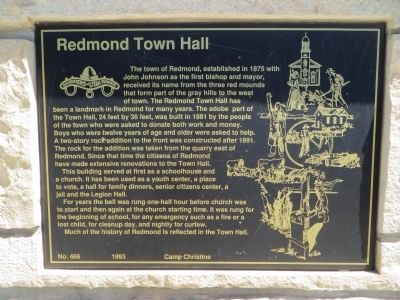
Redmond Town Hall. . The town of Redmond established in 1875 with John Johnson as the first Bishop and Mayor, received its name from the three red mounds that form part of the grey hills to the west of town. The Redmond Town Hall has been a landmark in Redmond for many years. The adobe part of the Town Hall 24 feet x 36 feet was built in 1881 by the people of the town who were asked to donate both work and money. Boys who were twelve years of age and older were asked to help. A two-story rock addition to the front was constructed after 1891. The rock for the addition was taken from the quarry east of Redmond. Since that time the citizens of Redmond have made extensive renovations to the Town Hall. , This building served at first as a schoolhouse and a church. It has been used as a youth center, a place to vote, a hall for family dinners, senior citizens center, a jail, and the Legion Hall. , For years the bell was rung one-half hour before church was to start and then again at the church starting time. It was rung for the beginning of school, for any emergency such as a fire or a lost child, for cleanup day, and nightly for curfew. , Much of the history of Redmond is reflected in the Town Hall.
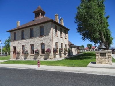
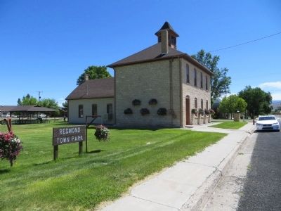
The town of Redmond established in 1875 with John Johnson as the first Bishop and Mayor, received its name from the three red mounds that form part of the grey hills to the west of town. The Redmond Town Hall has been a landmark in Redmond for many years. The adobe part of the Town Hall 24 feet x 36 feet was built in 1881 by the people of the town who were asked to donate both work and money. Boys who were twelve years of age and older were asked to help. A two-story rock addition to the front was constructed after 1891. The rock for the addition was taken from the quarry east of Redmond. Since that time the citizens of Redmond have made extensive renovations to the Town Hall.
This building served at first as a schoolhouse and a church. It has been used as a youth center, a place to vote, a hall for family dinners, senior citizens center, a jail, and the Legion Hall.
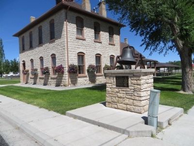
For years the bell was rung one-half hour before church was to start and then again at the church starting time. It was rung for the beginning of school, for any emergency such as a fire or a lost child, for cleanup day, and nightly for curfew.
Much of
Click or scan to see this page online
the history of Redmond is reflected in the Town Hall.
Erected 1993 by Camp Christine, Daughters of Utah Pioneers. (Marker Number 466.)
Topics and series. This historical marker is listed in this topic list: Notable Buildings. In addition, it is included in the Daughters of Utah Pioneers series list. A significant historical year for this entry is 1875.
Location. 39° 0.366′ N, 111° 51.88′ W. Marker is in Redmond, Utah, in Sevier County. It is at the intersection of West Main Street and North Center Street, on the right when traveling west on West Main Street. Marker is on the northwest corner. Touch for map. Marker is in this post office area: Redmond UT 84652, United States of America. Touch for directions.
Regionally, this marker is in the Central Utah Valleys. It is also in the American Mountain West and in Colorado Plateau. Globally, it is in North America, the Western Hemisphere, the Western World, and the Anglosphere. Historically, it finds itself in what was once New Spain and also Mexico’s Alta California.
Other nearby markers. At least 8 other markers are within 9 miles of this marker, measured as the crow flies:
Credits. This page was last revised on June 16, 2016. It was originally submitted on June 26, 2014, by Bill Kirchner of Tucson, Arizona. This page has been viewed 1,153 times since then and 54 times this year. Photos:1, 2, 3, 4. submitted on June 26, 2014, by Bill Kirchner of Tucson, Arizona. • Syd Whittle was the editor who published this page.