Ephraim in Sanpete County, Utah — The American Mountains (Southwest)
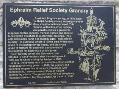
Ephraim Relief Society Granary
Relief Society Wheat and flour were contributed to San Francisco after the earthquake in 1906 and to China during the famine in 1907.
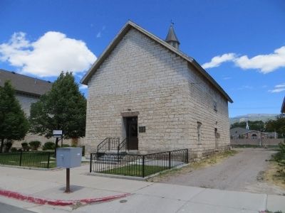
In 1915, the granary was converted to a flour mill that functioned for forty years. In 1969, the granary and adjoining cooperative store were threatened with demolition but were preserved through valiant community efforts. The granary interior was completely reconstructed into The Central Utah Art Center in 1990.
Erected 1996 by Fort Ephraim Camp, Daughters of Utah Pioneers. (Marker Number 495.)
Topics and series. This historical marker is listed in these topic lists: Churches & Religion • Notable Buildings • Settlements & Settlers. In addition, it is included in the Daughters of Utah Pioneers series list. A significant historical year for this entry is 1876.
Location. 39° 21.666′ N, 111° 35.214′ W. Marker is in Ephraim, Utah, in Sanpete County. Marker is on North Main Street south of 100 North Street, on the right when traveling north. Touch for map. Marker is in this post office area: Ephraim UT 84627, United States of America. Touch for directions.
Other nearby markers. At least 8 other markers are within walking distance of this marker. Ephraim Co-op Building (within shouting distance of this marker); The Old Fort (within shouting distance of this marker); Fort Ephraim Peace Treaty (about 300 feet away, measured in a direct line); Canute Peterson House (about 400 feet away); John Dorius, Jr., House and Barn (about 400 feet away); Hansen-Sparks Home (about 500 feet away); Ephraim Carnegie Library (about 700 feet away); Fort Ephraim (about 700 feet away). Touch for a list and map of all markers in Ephraim.
Credits. This page was last revised on June 16, 2016. It was originally submitted on July 2, 2014, by Bill Kirchner of Tucson, Arizona. This page has been viewed 471 times since then and 12 times this year. Photos: 1, 2, 3. submitted on July 2, 2014, by Bill Kirchner of Tucson, Arizona. • Syd Whittle was the editor who published this page.


