Pasadena in Anne Arundel County, Maryland — The American Northeast (Mid-Atlantic)
Prime View
Star-Spangled Banner National Historic Trail
— National Park Service, U.S. Department of the Interior —
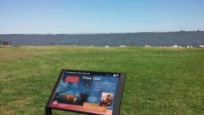
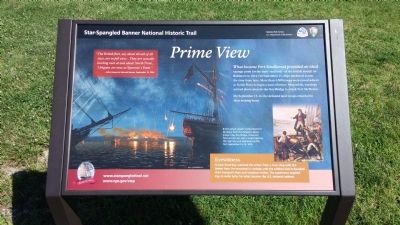
What became Fort Smallwood provided an ideal vantage point for the start - and end - of the British assalut on Baltimore in 1814. On September 11, ships anchored across the river from here. More than 4,500 troops were rowed ashore at North Point to begin a land offensive. Meanwhile, warships arrived above present-day Key Bridge to attack Fort McHenry.
On September 15-16, the defeated land troops returned to their waiting boats.
"The British fleet, say about 40 sail of all sizes, are in full view… They are actually landing men at and about North Point… 3 frigates are now at Sparrow's Point." - John Hewes to Edward Hewes, September 12, 1814
[Captions:]
British attack vessels bombarded Fort McHenry from the Patapsco above present-day Key Bridge. Observers here would have seen rockets lighting the night sky and explosions at the fort, September 13-14, 1814.
Eyewitness
Francis Scott Key watched the action from a truce ship with the British Fleet. He remained in custody until the soldiers had re-boarded their transport ships and weighed anchor. The experience inspired Key to write lyrics for what became the U.S. national anthem.
Erected by National Park Service, U.S. Department of the Interior.
Topics and series. This historical marker is listed in this topic list: War of 1812. In addition, it is included in the Star Spangled Banner National Historic Trail series list. A significant historical month for this entry is September 1864.
Location. 39° 10.002′ N, 76° 28.737′ W. Marker is in Pasadena, Maryland, in Anne Arundel County. Marker is on Bay Front Drive, half a mile north of Fort Smallwood (Route 173), on the right. Marker is inside Fort Smallwood Park. Bay Front Drive is wholly inside the park. Touch for map. Marker is in this post office area: Pasadena MD 21122, United States of America. Touch for directions.
Other nearby markers. At least 8 other markers are within 3 miles of this marker, measured as the crow flies. Fort Smallwood Park Flagpole (approx. 0.3 miles away); The History of Ft Smallwood Park (approx. 0.4 miles away); a different marker also named The History of Ft Smallwood Park (approx. 0.4 miles away); Preservation in Progress (approx. 0.4 miles away); Bill Burton Fishing Pier (approx. half a mile away); Veterans of Foreign Wars (approx. 1.6 miles away); In Memoriam (approx. 2.3 miles away); Observing the Enemy (approx. 2.7 miles away). Touch for a list and map of all markers in Pasadena.
Regarding Prime View. The Key Bridge referenced in the inscription collapsed on March 26, 2024.

Photographed By F. Robby, July 5, 2014
3. Key Bridge
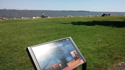
Viewed from the marker, the Key Bridge (4 miles away) is barely visible in this photograph, but directly above the sign where the water meets the sky. Fort McHenry is out of view, but another 4 miles by water beyond the bridge. Just north or south of the bridge is where historians believe Francis Scott Key observed the bombardment of the Fort, and drafted the words to the Star Spangled Banner.
Credits. This page was last revised on April 7, 2024. It was originally submitted on July 5, 2014, by F. Robby of Baltimore, Maryland. This page has been viewed 547 times since then and 35 times this year. Last updated on April 6, 2024, by Carl Gordon Moore Jr. of North East, Maryland. Photos: 1, 2, 3. submitted on July 5, 2014, by F. Robby of Baltimore, Maryland. • Devry Becker Jones was the editor who published this page.
Editor’s want-list for this marker. A wide shot of the entire marker in context. • Can you help?

