Near Reedsville in Preston County, West Virginia — The American South (Appalachia)
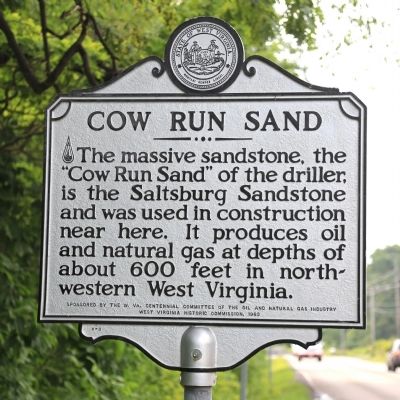
Cow Run Sand
Erected 1963 by West Virginia Historic Commission, and sponsored by the W. Va. Centennial Committee of the Oil and Natural Gas Industry. (Marker Number H-3.)
Topics and series. This historical marker is listed in this topic list: Natural Resources. In addition, it is included in the West Virginia Archives and History series list.
Location. 39° 30.618′ N, 79° 45.876′ W. Marker is near Reedsville, West Virginia, in Preston County. Marker is on West Virginia Route 7 just east of Indian Rock Road, on the left when traveling west. Touch for map. Marker is in this post office area: Reedsville WV 26547, United States of America. Touch for directions.
Other nearby markers. At least 8 other markers are within 3 miles of this marker, measured as the crow flies. “Arthurdale” (approx. 2.8 miles away); Service Station (approx. 2.9 miles away); Administration Building (approx. 2.9 miles away); The Forge (approx. 2.9 miles away); Community At Arthurdale (approx. 2.9 miles away); Honor Roll (approx. 2.9 miles away); The Great Hall (approx. 2.9 miles away); a different marker also named Arthurdale (approx. 2.9 miles away).
Credits. This page was last revised on June 16, 2016. It was originally submitted on July 6, 2014, by J. J. Prats of Powell, Ohio. This page has been viewed 854 times since then and 84 times this year. Photos: 1, 2. submitted on July 6, 2014, by J. J. Prats of Powell, Ohio.

