Morristown in Morris County, New Jersey — The American Northeast (Mid-Atlantic)
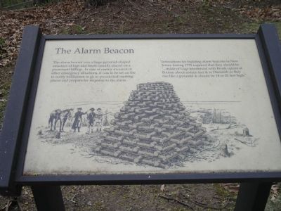
The Alarm Beacon
Instructions for building alarm beacons in New Jersey during 1779 required that they should be “…made of Logs intermixed with Brush square at Bottom about sixteen feet & to Diminish as they rise like a pyramid & should be 18 or 20 feet high.”
Erected by Morristown National Historical Park.
Topics. This historical marker is listed in this topic list: War, US Revolutionary. A significant historical year for this entry is 1779.
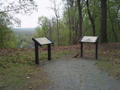
Location. 40° 47.608′ N, 74° 29.301′ W. Marker is in Morristown, New Jersey, in Morris County. Marker can be reached from Chestnut Street, on the left when traveling south. Marker is in Morristown National Historical Park, in the Fort Nonsense section, off Chestnut Street. Touch for map. Marker is in this post office area: Morristown NJ 07960, United States of America. Touch for directions.
Other nearby markers. At least 8 other markers are within walking distance of this marker. Chain of Signal Beacons (here, next to this marker); Fort Nonsense (within shouting distance of this marker); a different marker also named Fort Nonsense (within shouting distance of this marker); The Lay of the Land (within shouting distance of this marker); Morristown (within shouting distance of this marker); The Upper Redoubt (about 300 feet away, measured in a direct line); Iron (about 300 feet away); Mt. Kemble Home (approx. ¼ mile away). Touch for a list and map of all markers in Morristown.
More about this marker. The marker features a picture of three Continental soldiers in front of a pyramid of logs, waiting to be lit when necessary.
Also see . . . Fort Nonsense. Morristown National Historical Park. (Submitted on May 1, 2008, by Bill Coughlin of Woodland Park, New Jersey.)
Credits. This page was last revised on June 16, 2016. It was originally submitted on May 1, 2008, by Bill Coughlin of Woodland Park, New Jersey. This page has been viewed 1,126 times since then and 19 times this year. Photos: 1, 2. submitted on May 1, 2008, by Bill Coughlin of Woodland Park, New Jersey. • Kevin W. was the editor who published this page.

