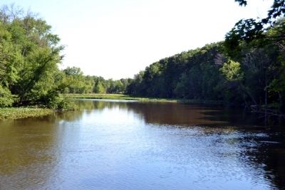
Near Three Rivers in St. Joseph County, Michigan — The American Midwest (Great Lakes)
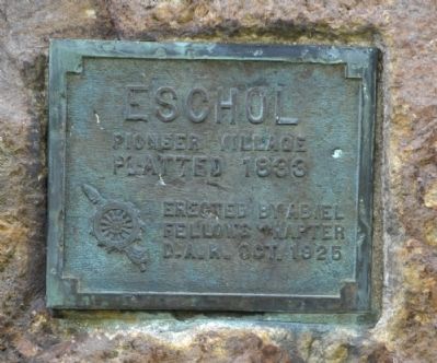
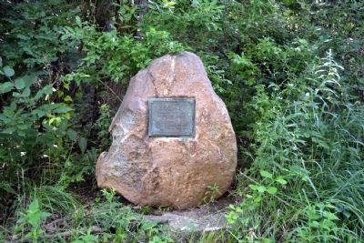
Eschol
Pioneer Village
Platted 1833
Erected by Abiel
Fellows Chapter
D.A.R. Oct. 1925
Erected 1925 by Abiel Fellows Chapter of the Daughters of the American Revolution.
Topics and series. This historical marker is listed in this topic list: Settlements & Settlers. In addition, it is included in the Daughters of the American Revolution series list. A significant historical year for this entry is 1833.
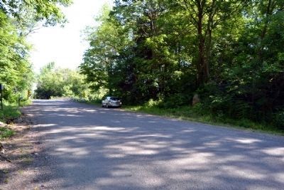
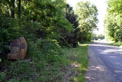
Location. 41° 54.557′ N, 85° 38.349′ W. Marker is near Three Rivers, Michigan, in St. Joseph County. Marker is on Constantine Road, 0.1 miles north of Shorewood Drive, on the right when traveling north. Touch for map. Marker is in this post office area: Three Rivers MI 49093, United States of America. Touch for directions.
Other nearby markers. At least 8 other markers are within 3 miles of this marker, measured as the crow flies. Moab (approx. 1.6 miles away); French Trading Post (approx. 2.2 miles away); Site of Legendary Battle (approx. 2.3 miles away); Three Rivers Elks #1248 (approx. 2.3 miles away); Three Rivers Town Cannon (approx. 2.3 miles away); The First Grist Mill in Three Rivers (approx. 2.3 miles away); The Meneely Bell (approx. 2.3 miles away); Three Rivers (approx. 2.3 miles away). Touch for a list and map of all markers in Three Rivers.
Also see . . .
1. Pioneer Washing Place at "Eschol" . Historic image from the Three Rivers (Michigan) Library. (Submitted on January 1, 2015, by Duane Hall of Abilene, Texas.)
2. Drumhillers Bridge at "Eschol". Historic image from the Three Rivers (Michigan) Library. (Submitted on January 1, 2015, by Duane Hall of Abilene, Texas.)
Additional commentary.
1. History of Eschol
Eschol is not a new name to the D.A.R. Through Mrs. Anna Barrows we first heard of this old deserted village located on the Frank Fitch farm just south of Three Rivers. The records state that it was platted by Charles B. Fitch and Asa Wetherbee in 1833, from a survey by J.S. Barry. The lots were 66 ft. front, 157 deep. The streets running east and west were Nottawa, Water, Short, Cass, Fayette, LaGrange. Those running north and south were St. Joseph, Pigeon and Lake, and a lake was either there or to be there, containing thirty and eighteen one-hundredths acres. This old village which proved but a dream has for its marker, we are told, broken stones from the old mill, a post or two of a ruined cottage and besides them a few bushes of purple lilac.
Source (Public Domain): Silliman, Sue I. "Paper Villages of St. Joseph County." Michigan History Magazine: Official Organ of the Michigan Historical Commission and the Michigan Pioneer and Historical Society IV.II-III (April-July 1920): 591. Print.
Among the villages platted in Constantine township was the village of Eschol. The records show that this, the deserted village of St. Joseph, was located on the Fitch farm, later the property of Charles Houser, three miles south of Three Rivers. It was platted by Judge Charles Fitch and Asa Wetherbee from a survey made by John S. Barry in 1833.
Concerning the platters, Judge Charles B. Fitch, was born in Connecticut, in 1774. He was the grandson of the famous Hon. Thomas Fitch, Governor of Connecticut under British rule. Hezekiah Fitch son of Thomas, served with the American forces during the Revolution, in the Seventh Connecticut regiment. He enlisted July 8, 1775. The family numbers among its prized possessions, his sword which bears the inscription: "Hezikiah Fitch, 1764" Charles B. Fitch was a son of Hezekiah, he served in the war of 1812 on Lake Erie. Charles and his son Samuel both served in the Black Hawk war under Captain Calhoun. Accompanied by his family Judge Fitch settled in St. Joseph county in 1830. He "entered five eighties of government land on Pigeon prairie, and the following year entered two hundred acres in Buck's township". For several years Mr. Fitch served as a circuit judge in St. Joseph county.
The partner of Judge Fitch, Asa Wetherbee (1800-1877), was the son of Richard
(1768-1848) and his wife Susannah Sweet Wetherbee (1778-1813). Asa was descended from John Wetherbee who immigrated to Woburn, Massachussetts, from England, about 1680.
In 1832 Judge Fitch built a dam across the Prairie river (Hog Creek) near the outlet into the St. Joseph river. This dam backed the waters of the creek until they overflowed the lowlands near the present location of the New York Central bridge. It made a millpond where now the river road crosses the marsh. The mill race flowed through the ravine which forms the approach to the Drumhiller bridge.
The mill race made an island of about sixty acres of highland, on which stood the hamlet of Eschol. "Where the race entered the St. Joseph, Judge Fitch installed a busy water wheel to drive a saw mill, later a shingle mill and two run of small gristing stones. In 1838 R. M. Welch added a carding machine.
For a time the little village flourished and was a rival of the newly founded town of Three Rivers. In 1840 the dam went out, never to be rebuilt. Litigation followed. Buildings were vacated, the town deserted.
A few century-old apple trees, planted by Judge Fitch, a lilac bush growing on the high hillside which over looks the river, are all that remains of the little village of Eschol.
Source (Public Domain): Silliman, Sue I. St. Joseph in Homespun: A Centennial Souvenir. Three Rivers, Michigan: Three Rivers Publishing Co., 1931. 128-129. Print.
— Submitted January 1, 2015, by Duane Hall of Abilene, Texas.
Credits. This page was last revised on June 16, 2016. It was originally submitted on July 13, 2014, by Duane Hall of Abilene, Texas. This page has been viewed 843 times since then and 49 times this year. Photos: 1, 2, 3, 4, 5. submitted on July 13, 2014, by Duane Hall of Abilene, Texas.
