Scipio in Millard County, Utah — The American Mountains (Southwest)
Scipio Town Hall
Utah Historic Site
Photographed by Bill Kirchner, June 15, 2014
1. Scipio Town Hall Marker
Inscription.
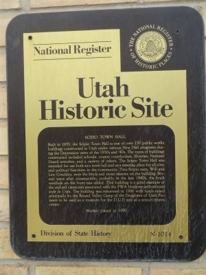
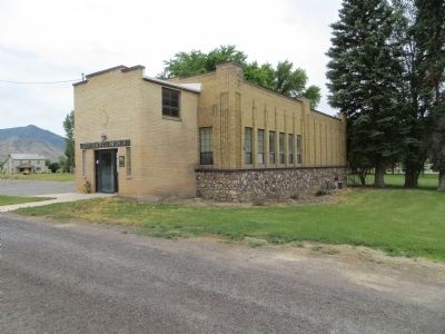
Scipio Town Hall. Utah Historic Site. Built in 1935, the Scipio Town Hall is one of over 230 public works buildings constructed in Utah under various New Deal programs during the Depression years of the 1930's and 40's. The types of buildings constructed included schools, county courthouses, libraries, National Guard Armories and a variety of others. The Scipio Town Hall was intended for use both as a town hall and as a meeting place for all civic and political functions in the community. Two Scipio men Will and Lew Critchley were the brick and stone masons on the building. Several years after construction, probably in the late 1940's, the brick vestibule on the front was added. This building is a good example of the stylized classicism associated with the PWA Moderne architectural style in Utah. The building was renovated in 1986 with funds raised principally by the Round Valley Camp of the Daughters of Utah Pioneers to be used as a museum for the D.U.P. and as a Senior Citizens Center.
Built in 1935, the Scipio Town Hall is one of over 230 public works buildings constructed in Utah under various New Deal programs during the Depression years of the 1930's and 40's. The types of buildings constructed included schools, county courthouses, libraries, National Guard Armories and a variety of others. The Scipio Town Hall was intended for use both as a town hall and as a meeting place for all civic and political functions in the community. Two Scipio men Will and Lew Critchley were the brick and stone masons on the building. Several years after construction, probably in the late 1940's, the brick vestibule on the front was added. This building is a good example of the stylized classicism associated with the PWA Moderne architectural style in Utah. The building was renovated in 1986 with funds raised principally by the Round Valley Camp of the Daughters of Utah Pioneers to be used as a museum for the D.U.P. and as a Senior Citizens Center.
Erected 1990 by Division of State History. (Marker Number N-1014.)
Topics. This historical marker is listed in this topic list: Notable Buildings. A significant historical year for this entry is 1935.
Location. 39° 14.759′ N, 112° 6.249′ W. Marker is in Scipio, Utah, in Millard County. It is on North State
Click or scan to see this page online
Street south of 100 North Street, on the right when traveling south. Touch for map. Marker is in this post office area: Scipio UT 84656, United States of America. Touch for directions.
Regionally, this marker is in the Central Utah Valleys and in the West Desert. It is also in the American Mountain West and in Colorado Plateau. Globally, it is in North America, the Western Hemisphere, the Western World, and the Anglosphere. Historically, it finds itself in what was once New Spain and also Mexico’s Alta California.
Other nearby markers. At least 5 other markers are within 14 miles of this marker, measured as the crow flies: Settlement of Scipio (within shouting distance of this marker); Rolling Out Of The Past (approx. 9.9 miles away); Holden (approx. 13 miles away); Heritage Bell (approx. 13.3 miles away); Cedar Springs Fort (approx. 13.4 miles away).
Photographed by Bill Kirchner, June 15, 2014
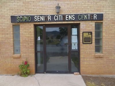
2. Scipio Town Hall Marker
Photographed by Bill Kirchner, June 15, 2014
3. Scipio Town Hall
Credits. This page was last revised on June 16, 2016. It was originally submitted on July 18, 2014, by Bill Kirchner of Tucson, Arizona. This page has been viewed 755 times since then and 28 times this year. Photos:1, 2, 3. submitted on July 18, 2014, by Bill Kirchner of Tucson, Arizona. • Syd Whittle was the editor who published this page.