Bellefontaine in Logan County, Ohio — The American Midwest (Great Lakes)
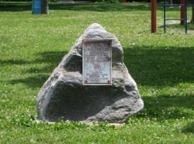
Powell Park, the Old Burial Ground
Major John Tullis and William Powell
— the Founders of Bellefontaine —
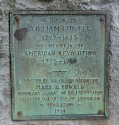
William Powell
1757- 1835
who fought in the
American Revolution
1775- 1783
erected by his grand daughter
Mary Powell
Honorary regent of Bellefontaine
Chapter Daughters of the American
Revolution
1914
Erected 1914 by Daughters of the American Revolution.
Topics and series. This historical marker is listed in this topic list: Settlements & Settlers. In addition, it is included in the Daughters of the American Revolution series list. A significant historical year for this entry is 1835.
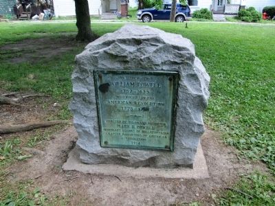
Location. 40° 21.832′ N, 83° 45.765′ W. Marker is in Bellefontaine, Ohio, in Logan County. Marker is at the intersection of Oakland Square and North Elm Street, on the left when traveling east on Oakland Square. there are two markers, in a small city park, behind the First Lutheran Church. Park is bounded by Oakland Square, North Elm, West Brown, and Central Court. Touch for map. Marker is at or near this postal address: 200 Oakland Square, Bellefontaine OH 43311, United States of America. Touch for directions.
Other nearby markers. At least 8 other markers are within walking distance of this marker. Signing Friendship Pact (about 600 feet away, measured in a direct line); The Railroad in Logan County (about 800 feet away); H.M. Annat Dry Goods & Montgomery Ward Store (approx. 0.2 miles away); The Cozy Picture Palace (approx. 0.2 miles away); Free Servicemen's Canteen, 1942-1946 (approx. 0.2 miles away); The Gorges Building (approx. 0.2 miles away); Clarence L Knowlton Library (approx. 0.2 miles away); Bellefontaine World War I Memorial (approx. 0.2 miles away). Touch for a list and map of all markers in Bellefontaine.
More about this marker. text of second marker-
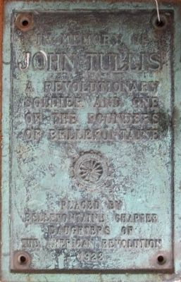
John Tullis
a Revolutionary
soldier and one
of the founders
of Bellefontaine
(DAR emblem)
placed by
Bellefontaine chapter
Daughters of
The American Revolution
1928
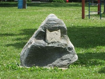
Regarding Powell Park, the Old Burial Ground. The plaque of the second marker is missing. It has been located at the Logan county Historical Society Museum, on East Columbus, in Bellefontaine.
I created a photo to show the plaque in place
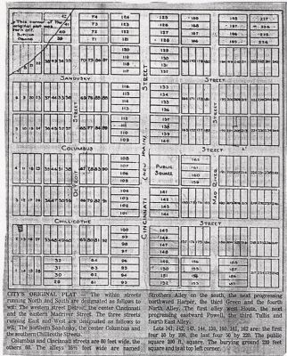
Additional keywords. Northwest corner of the original city plat
Photographed By Rev. Ronald Irick, circa 1820
6. original plat of Bellefontaine, Ohio, from the personal archives of Dr. Ronald Irick
the upper left corner (Northwest) is the original burial ground. Many years later the Bellefontaine Cemetery was laid out on the east side of town. The old burial ground then became a City Park. The DAR marked the grave sites of the two founders of the city.
Credits. This page was last revised on June 16, 2016. It was originally submitted on July 31, 2014, by Rev. Ronald Irick of West Liberty, Ohio. This page has been viewed 840 times since then and 37 times this year. Photos: 1, 2, 3, 4, 5, 6. submitted on July 31, 2014, by Rev. Ronald Irick of West Liberty, Ohio. • Al Wolf was the editor who published this page.
