Mayfield in Fulton County, New York — The American Northeast (Mid-Atlantic)
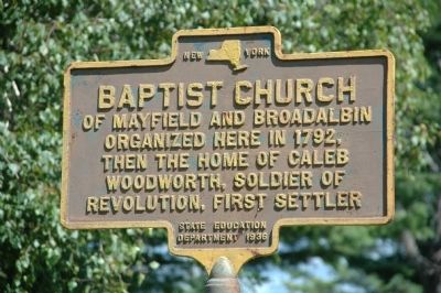
Baptist Church
Organized Here in 1792,
Then The Home of Caleb
Woodworth, Soldier Of
Revolution, First Settler
Erected 1936 by New York State Education Department.
Topics. This historical marker is listed in these topic lists: Churches & Religion • Patriots & Patriotism • Settlements & Settlers • War, US Revolutionary. A significant historical year for this entry is 1792.
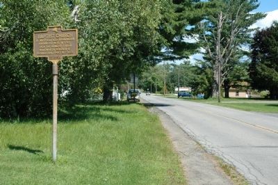
Location. 43° 5.384′ N, 74° 17.363′ W. Marker is in Mayfield, New York, in Fulton County. Marker is on Riceville Road, on the right when traveling west. Marker is about a tenth of a mile east of the Riceville Road-Route 30A intersection. Touch for map. Marker is at or near this postal address: 127 Riceville Road, Mayfield NY 12117, United States of America. Touch for directions.
Other nearby markers. At least 8 other markers are within 2 miles of this marker, measured as the crow flies. Woodworth Farm (approx. ¼ mile away); Riceville Cemetery (approx. 0.4 miles away); Captain Solomon Woodworth (approx. half a mile away); Anthonyville (approx. 0.9 miles away); Rice Homestead (approx. 0.9 miles away); Amasa Stephen (approx. one mile away); Burying Ground (approx. 1.2 miles away); Dutch Reformed Church of Mayfield (approx. 1.6 miles away). Touch for a list and map of all markers in Mayfield.
Credits. This page was last revised on June 16, 2016. It was originally submitted on August 25, 2014, by Howard C. Ohlhous of Duanesburg, New York. This page has been viewed 386 times since then and 22 times this year. Photos: 1, 2. submitted on August 25, 2014, by Howard C. Ohlhous of Duanesburg, New York. • Bill Pfingsten was the editor who published this page.

