Manteo in Dare County, North Carolina — The American South (South Atlantic)
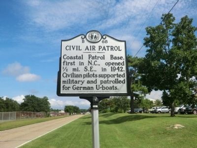
Civil Air Patrol
Erected 2012 by North Carolina Office of Archives and History. (Marker Number B-68.)
Topics and series. This historical marker is listed in these topic lists: Air & Space • War, World II. In addition, it is included in the North Carolina Division of Archives and History series list. A significant historical year for this entry is 1942.
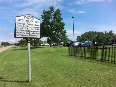
Location. 35° 55.156′ N, 75° 42.294′ W. Marker is in Manteo, North Carolina, in Dare County. Marker is at the intersection of Airport Road (County Route 1116) and Old County Road, on the right when traveling east on Airport Road. Touch for map. Marker is in this post office area: Manteo NC 27954, United States of America. Touch for directions.
Other nearby markers. At least 8 other markers are within 2 miles of this marker, measured as the crow flies. Joachim Gans (approx. one mile away); First English Colonies (approx. one mile away); R. A. Fessenden (approx. one mile away); Fort Blanchard (approx. 1.1 miles away); Freedmen's Colony (approx. 1.2 miles away); Fort Huger (approx. 1.2 miles away); Windmills on Roanoke Island (approx. 1.2 miles away); Naval Battle of Roanoke Island (approx. 1.2 miles away). Touch for a list and map of all markers in Manteo.

Photographed By Don Morfe, August 12, 2014
3. Former Slaves Burying Ground Memorial
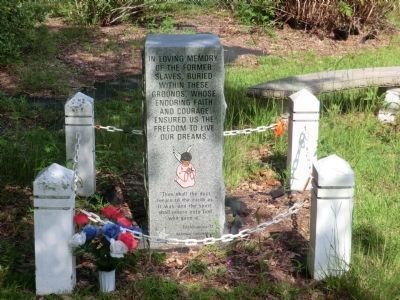
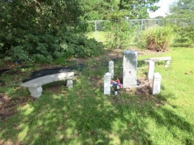
Across the street from the marker is this memorial, erected by the National Underground Railroad. It reads:
In loving memory of the former slaves, buried within these grounds, whose enduring faith and courage ensured us the freedom to live our dreams.
"Then shall the dust return to the earth as it was and the spirit shall return unto God who gave it."
Ecclesiastes 12
In loving memory of the former slaves, buried within these grounds, whose enduring faith and courage ensured us the freedom to live our dreams.
"Then shall the dust return to the earth as it was and the spirit shall return unto God who gave it."
Ecclesiastes 12
Credits. This page was last revised on March 17, 2024. It was originally submitted on September 1, 2014, by Don Morfe of Baltimore, Maryland. This page has been viewed 633 times since then and 58 times this year. Photos: 1, 2, 3, 4. submitted on September 1, 2014, by Don Morfe of Baltimore, Maryland. • Bernard Fisher was the editor who published this page.


