St. Paul in Howard County, Nebraska — The American Midwest (Upper Plains)
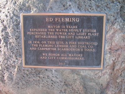
Ed Fleming
Expanded the water supply system.
Purchased the power and light plant.
Established the city library.
In 1936, on this site, a fire destroyed the Fleming Lumber and Coal Company and Carpenter Scarbourgh's Tools.
We honor all mayors and city commissioners.
Erected 2011.
Topics. This historical marker is listed in this topic list: Charity & Public Work. A significant historical year for this entry is 1936.
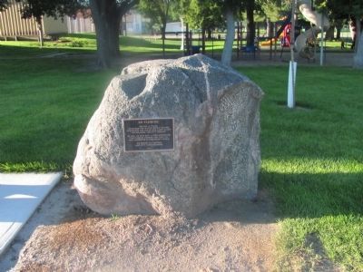
Location. 41° 12.816′ N, 98° 27.348′ W. Marker is in St. Paul, Nebraska, in Howard County. Marker is on Howard Street, 0.1 miles 5th Street, on the left when traveling west. The historical marker is on the south side of a city park at the east end of the business district. It is about a half block west of the Grover Cleveland Alexander State Historical marker. Touch for map. Marker is in this post office area: Saint Paul NE 68873, United States of America. Touch for directions.
Other nearby markers. At least 3 other markers are within 6 miles of this marker, measured as the crow flies. Grover Cleveland Alexander (a few steps from this marker); Howard County Courthouse (about 500 feet away, measured in a direct line); St. Wenceslaus Catholic Cemetery, Warsaw (approx. 6 miles away).
Credits. This page was last revised on June 16, 2016. It was originally submitted on September 7, 2014, by Joan Shurtliff of Seward, Nebraska. This page has been viewed 417 times since then and 9 times this year. Photos: 1, 2. submitted on September 7, 2014, by Joan Shurtliff of Seward, Nebraska. • Andrew Ruppenstein was the editor who published this page.

