Altstadt in Erfurt, Thuringia, Germany — Central Europe
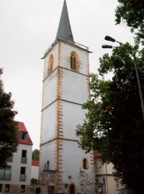
Nikolai Church Tower / Nikolaikirchturm
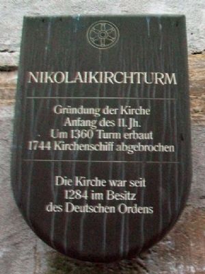
Inscription.
beginning of the 11th century
Tower built around 1360
Nave removed 1744
The church has been in the possession
of the Teutonic Order since 1284
————————
Gründung der Kirche
Anfang des 11. Jh.
Um 1360 Turm erbaut
1744 Kirchenschiff abgebrochen
Die Kirche was seit
1284 im Besitz
des Deutschen Ordens
Erected by City of Erfurt.
Topics. This historical marker is listed in this topic list: Churches & Religion. A significant historical year for this entry is 1360.
Location. 50° 58.859′ N, 11° 1.701′ E. Marker is in Altstadt, Thüringen (Thuringia), in Erfurt. Marker is at the intersection of Augustinerstraße and Am Hügel, on the left when traveling west on Augustinerstraße. Touch for map. Marker is at or near this postal address: Augustinerstraße 17, Altstadt TH 99084, Germany. Touch for directions.
Other nearby markers. At least 8 other markers are within walking distance of this marker. Willi Münzenberg (within shouting distance of this marker); Lehmannsbrücke / Lehmanns Bridge (within shouting distance of this marker); Childhood Home of Friedrich Wilhelm Ritschl (about 90 meters away, measured in a direct line); Martin Luther (about 90 meters away); General Medical Insurance Building (AOK) (about 120 meters away); Augustinian Monastery (about 120 meters away); Luther Trail Points of Interest / Sehenswertes am Lutherweg (about 120 meters away); Ratsgymnasium / Council Secondary School (about 120 meters away).
Also see . . . Teutonic Order. (Submitted on September 8, 2014, by William Fischer, Jr. of Scranton, Pennsylvania.)
Credits. This page was last revised on January 28, 2022. It was originally submitted on September 8, 2014, by William Fischer, Jr. of Scranton, Pennsylvania. This page has been viewed 649 times since then and 8 times this year. Photos: 1, 2. submitted on September 8, 2014, by William Fischer, Jr. of Scranton, Pennsylvania.

