Rothenburg ob der Tauber in Ansbach, Bavaria, Germany — Central Europe
Jews's Alley and Jewish Quarter
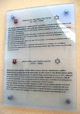
Judengasse und jüdisches Viertel
— (ca. 1371 - 1520) —
Im letzten Drittel des. 14. Jahrhunderts siedelten sich jüdische Einwohner auf dem Gebiet unmittelbar außerhalb der früheren Stadtmauer an.
Der Name „Judengasse” ist seit 1377 belegt. Sowohl jüdische als auch christliche Mieter wohnten in den Häusern.
Das Haus Judengasse 10 enthält eine Mikwe (jüdisches Ritualbad, Rekonstruktion im Reichsstadtmuseum). In der Gasse befanden sich eine koschere Schlachterei und eine jüdische Schule.
Nach der Vertreibung der Juden im Jahr 1520 wohnten überwiegend einfache Leute und Handwerker in den Häusern.
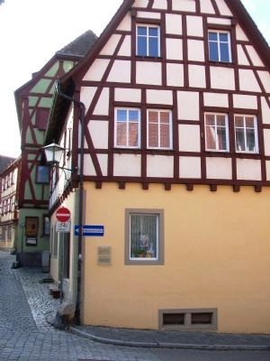
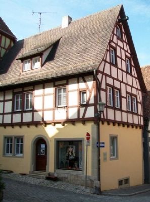
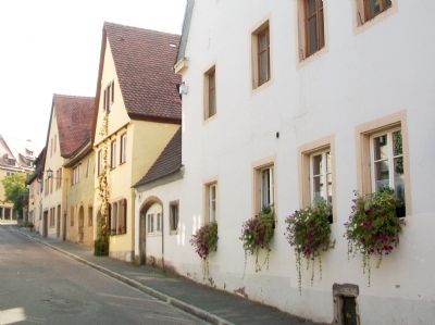
Das Ensemble mit 21 im Kern originalen Gebäuden ist die einzige noch erhaltene mittelalterliche Judengasse im deutschsprachigen Raum. Seit 1990 werden die Gebäude behutsam saniert.
————————
During the last quarter of the 14th century Jewish inhabitants settled immediately outside the first town wall, to the north of the White Tower gate.
The proper name of 'Judengasse', the Jews's Alley, can be traced back to 1377, although its houses were lived in by Jews and Christians alike. House No 10 contains a mikvah (a Jewish ritual bath, a reconstruction of which can be seen at the Reichsstadtmuseum). In this alley there were also a kosher butcher and a Jewish school.
After the Jewish citizens had been expelled in 1520, mainly ordinary people lived here. This group of 21 buildings, essentially still in their original form constitutes the only medieval quarter still remaining within the boundaries of German speaking countries. Since 1990 a careful and cautious renovation of these houses has been going on.
Erected by City of Rothenburg ob der Tauber.
Topics. This historical marker is listed in this topic list: Notable Places. A significant historical year for this entry is 1377.
Location. 49° 22.722′ N, 10° 10.738′ E. Marker is in Rothenburg ob der Tauber, Bayern (Bavaria), in Ansbach. Marker is at the intersection of Judengasse and Heugasse, on the right when traveling east on Judengasse. Touch for map. Marker is at or near this postal address: Heugasse 9, Rothenburg ob der Tauber BY 91541, Germany. Touch for directions.
Other nearby markers. At least 8 other markers are within walking distance of this marker. Schrannenscheune / Grain Storage Barn (within shouting distance of this marker); Granary / Jewish Cemetery (within shouting distance of this marker); St.-Michaels-Kapelle Rothenburg ob der Tauber / St Michaels Chapel (within shouting distance of this marker); Rabbi Meir ben Baruch von Rothenburg (about 120 meters away, measured in a direct line); St. Jakob's Church World War I Memorial (about 150 meters away); Pulverturm / Powder Tower
(about 150 meters away); Türme der Nordflanke / Towers of the north flank (about 150 meters away); Christian I (about 180 meters away). Touch for a list and map of all markers in Rothenburg ob der Tauber.
Also see . . . History of Rothenburg ob der Tauber. (Submitted on October 4, 2014, by William Fischer, Jr. of Scranton, Pennsylvania.)
Credits. This page was last revised on January 28, 2022. It was originally submitted on October 4, 2014, by William Fischer, Jr. of Scranton, Pennsylvania. This page has been viewed 498 times since then and 12 times this year. Photos: 1, 2, 3, 4, 5. submitted on October 5, 2014, by William Fischer, Jr. of Scranton, Pennsylvania.


