Dettelbach in Kitzingen, Bavaria, Germany — Central Europe
Dettelbach City Hall
Dettelbach Rathaus
Photographed by Andrew Ruppenstein, August 29, 2014
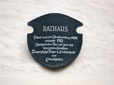
1. Dettelbach City Hall Marker
vollendet 1512.
Spätgotischer Bau auf zwei sich
kreuzenden Gewölben.
Doppelzügige Treppe m. Verkündhalle
und
Erkerchörlein.
Topics. This historical marker is listed in this topic list: Government & Politics. A significant historical year for this entry is 1484.
Location. 49° 48.134′ N, 10° 9.628′ E. Marker is in Dettelbach, Bayern (Bavaria), in Kitzingen. It is at the intersection of Rathausplatz and Local Route 2270 on Rathausplatz. Touch for map. Marker is in this post office area: Dettelbach BY 97337, Germany. Touch for directions.

Regionally, this marker is in German Franconia. Globally, it is in Europe, the European Union, Atlantic Europe, Central Europe, the Schengen Area, Western Europe, and the Western World. Historically, it finds itself in what was once the Holy Roman Empire and also the former West Germany.
this page online
Other nearby markers. At least 8 other markers are within 8 kilometers of this marker, measured as the crow flies: Dettelbach Synagogue (within shouting distance of this marker); The Bacchus Inn (about 120 meters away, measured in a direct line); Mainstockheim Synagogue (approx. 3.1 kilometers away); Schwarzach am Main (approx. 4.9 kilometers away); Evang.-luth. Stadtkirche / Protestant Lutheran City Church (approx. 7 kilometers away); Die "Kitzinger Elle" / The "Kitzingen Foot" (approx. 7 kilometers away); The Bombing of Kitzingen (approx. 7 kilometers away); Bartholomäus Dietwar (approx. 7.1 kilometers away). Touch for a list and map of all markers in Dettelbach.
Also see . . . Town Hall (Dettelbach). Wikipedia entry (Submitted on June 14, 2024, by Larry Gertner of New York, New York.)

Photographed by Andrew Ruppenstein, August 29, 2014
2. City Hall - East Side
Photographed by Andrew Ruppenstein, August 29, 2014
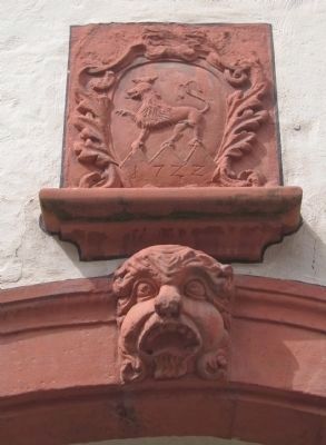
3. Decorative Element Above the Entryway
Photographed by Andrew Ruppenstein, August 29, 2014
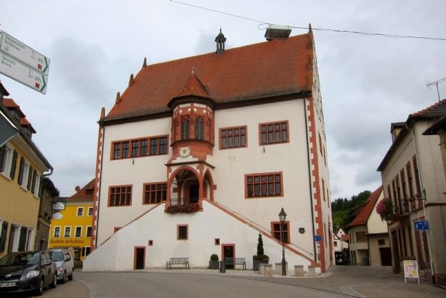
4. Dettelbach City Hall - South Side
Credits. This page was last revised on June 14, 2024. It was originally submitted on October 10, 2014, by Andrew Ruppenstein of Lamorinda, California. This page has been viewed 563 times since then and 9 times this year. Photos: 1, 2, 3, 4. submitted on October 10, 2014, by Andrew Ruppenstein of Lamorinda, California.
