Red Cloud in Webster County, Nebraska — The American Midwest (Upper Plains)
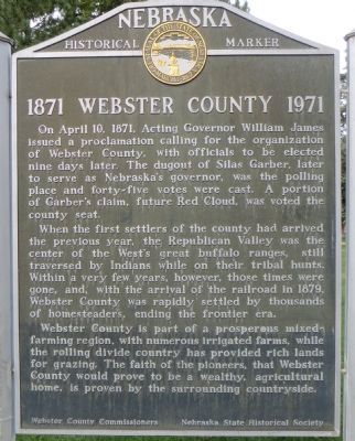
1871 Webster County 1971
When the first settlers of the county had arrived the previous year, the Republican Valley was the center of the West's great buffalo ranges, still traversed by Indians while on their tribal hunts. Within a very few years, however, those times were gone, and, with the arrival of the railroad in 1879, Webster County was rapidly settled by thousands of homesteaders, ending the frontier era.
Webster County is part of a prosperous mixed-farming region, with numerous irrigated farms, while the rolling divide country has provided rich lands for grazing. The faith of the pioneers, that Webster County would prove to be a wealthy, agricultural home, is proven by the surrounding countryside.
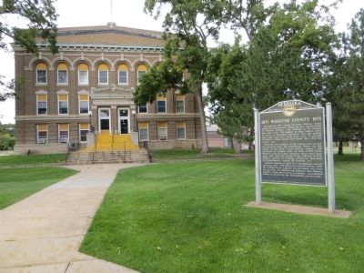
Erected by Webster County Commissioners and Nebraska State Historical Society. (Marker Number 123.)
Topics and series. This historical marker is listed in this topic list: Settlements & Settlers. In addition, it is included in the Nebraska State Historical Society series list. A significant historical month for this entry is April 1876.
Location. 40° 5.464′ N, 98° 31.277′ W. Marker is in Red Cloud, Nebraska, in Webster County. Marker is on West 6th Avenue west of North Cedar Street, on the right when traveling west. Touch for map. Marker is in this post office area: Red Cloud NE 68970, United States of America. Touch for directions.
Other nearby markers. At least 7 other markers are within 6 miles of this marker, measured as the crow flies. Grace Episcopal Church (within shouting distance of this marker); Cottonwood Tree - 1871 (approx. 0.2 miles away); Cather Childhood Home (approx. ¼ mile away); Red Cloud (approx. ¼ mile away); Red Cloud Volunteer Fire Department Bell (approx. ¼ mile away); Burlington Depot (approx. one mile away); Willa Cather Memorial Prairie (approx. 6 miles away).
Credits. This page was last revised on June 16, 2016. It was originally submitted on October 14, 2014, by Bill Kirchner of Tucson, Arizona. This page has been viewed 424 times since then and 9 times this year. Photos: 1, 2, 3. submitted on October 14, 2014, by Bill Kirchner of Tucson, Arizona. • Bill Pfingsten was the editor who published this page.


