Lake Arbor in Prince George's County, Maryland — The American Northeast (Mid-Atlantic)
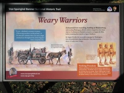
Weary Warriors
Star-Spangled Banner National Historic Trail
By August 30, after the successful campaign for Washington, they reboarded their ships at Benedict. They had traveled about 113 miles over 12 days.
“It was...absolutely necessary to pause... (T)hrowing ourselves on the ground...in less than five minutes there was not a single unclosed eye throughout the whole brigade.” — British Lt. George Robert Gleig
Erected 2014 by National Park Service.
Topics and series. This historical marker is listed in this topic list: War of 1812. In addition, it is included in the Star Spangled Banner National Historic Trail series list. A significant historical year for this entry is 1814.
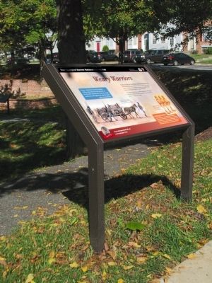
Location. 38° 54.191′ N, 76° 48.987′ W. Marker is in Lake Arbor, Maryland, in Prince George's County. Marker is on Lake Overlook Drive, on the right when traveling south. The marker is in Northampton Slave Quarters Park at 10915 Water Port Court. Touch for map. Marker is in this post office area: Bowie MD 20721, United States of America. Touch for directions.
Other nearby markers. At least 8 other markers are within 3 miles of this marker, measured as the crow flies. Archaeology at the Brick Quarters (a few steps from this marker); Seeking Freedom (within shouting distance of this marker); Northampton Slave Quarters and Archaeological Park (within shouting distance of this marker); Archaeology at the Frame Quarters (within shouting distance of this marker); “Mount Lubentia” (approx. 1.4 miles away); The Chesapeake Carousel (approx. 1.6 miles away); The History of Watkins Regional Park (approx. 1.8 miles away); Ridgley (approx. 2.1 miles away). Touch for a list and map of all markers in Lake Arbor.
Credits. This page was last revised on October 2, 2022. It was originally submitted on October 20, 2014, by Allen C. Browne of Silver Spring, Maryland. This page has been viewed 552 times since then and 12 times this year. Photos: 1, 2. submitted on October 20, 2014, by Allen C. Browne of Silver Spring, Maryland. • Bill Pfingsten was the editor who published this page.

