McKittrick in Kern County, California — The American West (Pacific Coastal)
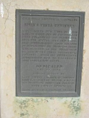
Buena Vista Refinery
California Historical Landmark
Erected 1954 by Kern County Historical Society, Miocene Parlor No.228 N.D.G.W., The Petroleum Production Pioneers, and Kern County Museum. (Marker Number 504.)
Topics and series. This historical marker is listed in these topic lists: Industry & Commerce • Natural Resources. In addition, it is included in the California Historical Landmarks, and the Native Sons/Daughters of the Golden West series lists. A significant historical month for this entry is April 1867.
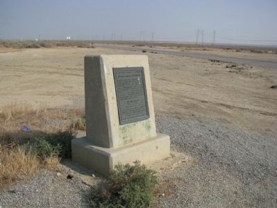
Location. 35° 23.862′ N, 119° 39.9′ W. Marker is in McKittrick, California, in Kern County. Marker is at the intersection of Lokern Road and Westside Highway (County Route 33), on the right when traveling west on Lokern Road. Marker is located on the northeast corner. Touch for map. Marker is in this post office area: Mc Kittrick CA 93251, United States of America. Touch for directions.
Other nearby markers. At least 4 other markers are within 13 miles of this marker, measured as the crow flies. McKittrick Hotel and Penny Bar (approx. 6.8 miles away); McKittrick Brea Pit (approx. 7.3 miles away); Buttonwillow Tree (approx. 10.8 miles away); Wallace Creek (approx. 12.7 miles away).
Credits. This page was last revised on March 6, 2022. It was originally submitted on January 21, 2012, by Denise Boose of Tehachapi, California. This page has been viewed 1,578 times since then and 55 times this year. Last updated on October 25, 2014, by James King of San Miguel, California. Photos: 1, 2, 3. submitted on January 21, 2012, by Denise Boose of Tehachapi, California. • Andrew Ruppenstein was the editor who published this page.


