Lunenburg in Lunenburg County, Nova Scotia — The Atlantic Provinces (North America)
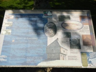
Defence of Lunenburg
La défense de Lunenburg

Photographed By Barry Swackhamer, June 16, 2014
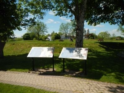
1. Defence of Lunenburg Marker
Captions (English / French): (top left) Images of cannons of historic Lunenburg. / Illustrations de cannons du Vieux-Lunenburg.; (right side, clockwise from the top right) Example of a cast-iron, smooth-bore gun. / Canon en fonte à âme lisse.; View of Lunenburg from the Southeast by Lieutenant H. Pooley, c 1820, depicting the blockhouse protecting the harbour. / Vue de Lunenburg prise du sud-est et montrant le blockhaus qui protégé le port, par du lieutenant H. Pooley, vers 1820.; Modern sketch of 1750’s blockhouse. / Représentation moderne d’un blockhaus de 1750.; Markings on 1819 gun located on golf course. / Marques figurant sur un canon de 1819 situé sur le terrain de golf.; Illustration of 18th century blockhouse. / Illustration d’un blockhaus de 18ᵉ siècle.; Markings on gun barrel showing weight in hundred weights. / Marques figurant sur un tube de canon et donnant le poids en «hundredweight» (unité équivalent à environ 100 livres).; Royal Cypher of Queen Victoria on gun at Blockhouse Hill. / Monogramme de la reine Victoria figurant sur un canon de Blockhouse Hill.; Townsite plan including fortifications and fences, 1752. / Plan de la ville y compris les ouvrages de défense et les palissades, 1752.
When the British settlement at Lunenburg was established in 1753, the Town plot was enclosed by pickets surrounding the east, north and west ends of the Town. The west end was fortified by four blockhouses placed at strategic intervals between the Front Harbour and the Back Harbour, and another on the east end on Blockhouse Hill. Each of these blockhouses formed a central “keep” of small heavily stockaded fortifications which were built to protect the new community from attack from land or sea. They were garrisoned by a combination of regular troops who had been sent out to protect the settlers and members of the local civilian militia. Most of these early structures soon fell into disrepair after the Acadians were expelled from the colony and a peace accord was made with the Mi’kmaq thus lessening the threat of attack.
During the American Revolutionary War in 1783 (sic), Lunenburg was attacked by Boston privateers. Despite a spirited defense of the community led by Colonel John Creighton, a senior magistrate, who managed to lead a small force to Blockhouse Hill, the attackers prevailed, burning and plundering a few houses. War with Revolutionary and Napoleonic France began in 1793 and lasted until 1815. During this period, the Town was again fortified. New defenses were built on Blockhouse Hill and at the old Fort Boscawen at the entrance to Lunenburg Harbour overlooking the present day High Liner Foods plant. The Town was never attacked and gradually these fortifications deteriorated.
Six cannons (guns) located at various sites around the town are all that is left of the efforts to defend Lunenburg in the 18th and 19th centuries. Can you find them?
French
Lorsque l’établissement de Lunenburg est ctéé par les Britanniques en 1753, la ville est protégée par une palissade qui entoure ses secteurs est, nord et ouest. On construit un blockhaus dans le secteur est à Blockhouse Hill. Quant au secteur ouest, il est fortifié par quatre blockhaus situés à des intervalles stratégiques entre Front Harbour et Back Harbour. Chaque blockhaus constitue une place forte centrale composée de petites fortifications entourées d’une lourde palissade dont le but est ed protéger la nouvelle communauté contre les attaques venant de la terre ou de la mer. Une combinaison de troupes régulières déployées pour protéger les colons et de membres de la milice civile locale en constitue la garnison. Une grand partie de ces premières structures se délabre après que les Acadian sont expulsés de la colonie et qu’un accord de paix est passé avec les Mi’kmaq réduisant ainsi le risque d’attaque.
Durant la Révolution américaine en 1783 (sic), Lunenburg
est attaquée par des corsaires bostonies. Malgré une vive défense de la communauté menée par le colonel John Creighton, magistrat principal, qui conduit un petite troupe à Blockhouse Hill, les agresseurs réussissante à brûler et à piller quelques maisons. La guerre avec la France révolutionnaire et napoléonienne commence en 1793 et se poursuit jusqu’en 1815. Durant cette période, la ville est encore fortifiée contre les attaques des forces françaises et américaines. De nouvelle défenses sont érigées à Blockhouse Hill et au vieux fort Boscawen situé à l’entrée du port de Lunenburg. soit à l’emplacement qui donne sur l’actuelle usine de High Liner Foods. La ville ne sera jamais attaquée et ces fortifications se dégradent petit à petit.
Six canons situés à différents endroits autour de la ville sont les seul vestiges de efforts déployés pour la défense de Lunenburg aux 18ᵉ et 19ᵉ siècles. Pouvez-vous les trouver?
Erected by Town of Lunenburg.
Topics. This historical marker is listed in these topic lists: Forts and Castles • War, US Revolutionary. A significant historical year for this entry is 1753.
Location. 44° 22.666′ N, 64° 18.266′ W. Marker is in Lunenburg, Nova Scotia, in Lunenburg County. Marker is at the intersection of Blockhouse Hill Road and Townsend Street, on the left when traveling north on Blockhouse Hill Road. Touch for map. Marker is at or near this postal address: 206 Blockhouse Hill Road, Lunenburg NS B0J, Canada. Touch for directions.
Other nearby markers. At least 8 other markers are within walking distance of this marker. The Sack of Lunenburg (here, next to this marker); Foreign Protestants & the Settlement of Lunenburg (here, next to this marker); Lunenburg’s Shipbuilding Tradition (approx. 0.3 kilometers away); Rum Running (approx. 0.4 kilometers away); “…for those in peril on the sea.” (approx. half a kilometer away); Lunenburg - Home of the Bluenose & Bluenose II (approx. half a kilometer away); Lunenburg’s Fishing Industry Since 1940’s (approx. half a kilometer away); The Labrador Whaler Anderson Bros. (approx. 0.6 kilometers away). Touch for a list and map of all markers in Lunenburg.
Credits. This page was last revised on October 12, 2021. It was originally submitted on October 26, 2014, by Barry Swackhamer of Brentwood, California. This page has been viewed 662 times since then and 31 times this year. Photos: 1, 2. submitted on October 26, 2014, by Barry Swackhamer of Brentwood, California. • Andrew Ruppenstein was the editor who published this page.
