Near Mountain Center in Riverside County, California — The American West (Pacific Coastal)
Kenworthy
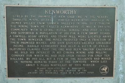
Photographed by Chris Bell, February 12, 2011
1. Kenworthy Marker
Erected 2007 by Billy Holcomb Chapter No. 1069 of the Ancient and Honorable Order of E Clampus Vitus. (Marker Number 132.)
Topics and series. This historical marker is listed in these topic lists: Industry & Commerce • Notable Places • Settlements & Settlers.
this page online
Location. 33° 39.648′ N, 116° 40.021′ W. Marker is near Mountain Center, California, in Riverside County. It is on Pines to Palms Highway (California Route 74) north of Forest Route 6S13, on the right when traveling south. Touch for map. Marker is in this post office area: Anza CA 92539, United States of America. Touch for directions.

Regionally, this marker is in Greater Los Angeles, in the Inland Empire, and in the Peninsular Ranges. It is also in the American Southwest. Globally, it is in North America, on the Ring of Fire, on the Pacific Rim, in the Western Hemisphere, in the Western World, and in the Anglosphere. Historically, it finds itself in what was once New Spain and also Mexico’s Alta California.
Other nearby markers. At least 8 other markers are within 8 miles of this marker, measured as the crow flies: Historic Lake Hemet Dam (approx. 0.8 miles away); Idyllwild Town Hall (approx. 6.3 miles away); The Idyllwild Monument (approx. 6.4 miles away); Hoxie-Vance Cabin (approx. 6.4 miles away); Camp Emerson
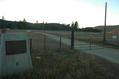
Photographed by Chris Bell, February 12, 2011
2. Kenworthy Marker
Credits. This page was last revised on June 16, 2016. It was originally submitted on January 9, 2012, by Michael Kindig of Elk Grove, California. This page has been viewed 3,222 times since then and 248 times this year. Last updated on November 3, 2014, by Michael Kindig of Elk Grove, California. Photos: 1, 2. submitted on January 9, 2012, by Michael Kindig of Elk Grove, California. • Bill Pfingsten was the editor who published this page.
