Annapolis Royal in Annapolis County, Nova Scotia — The Atlantic Provinces (North America)
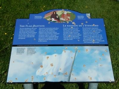
The Flag Bastion
Le bastion de l’étendard

Photographed By Barry Swackhamer, June 17, 2014
1. The Flag Bastion Marker
Captions (English / French): (top) A detail of the Fort Anne Heritage Tapestry depicting the 1726 treaty ratification. / Détail de la tapisserie historique du Fort-Anne montrant la ratification d’un traité en 1726.; (bottom panel) The French Ministry of the Marine was responsible for France’s colonies. While France held the fort, the white flag of the Ministry of the Marine flew here. / À cette époque, les colonies français relèvent du ministère français de la Marine. Ainsi, lorsque la France est en possession du fort, le ministère de la Marine y hisse son drapeau blanc.
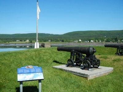
You are standing on the west bastion which, in the 1700s, was the principal bastion. This being the closest bastion to the river, a flag was flown here to show approaching vessels who controlled the stronghold.
Important ceremonies took place here. In 1726, the British Crown and chiefs of the Mi’kmaw, Maliseet and Abenaki nations ratified a treaty during a trilingual ceremony. Also in 1726, some Acadians of the Annapolis Royal area swore a conditional oath of allegiance to the British Crown at this bastion.
French
Vous êtes maintenant sur le bastion ouest qui, au cours de années 1700, est le bastion principal. Puisqu’il est tout près de la rivière, c’est ici que flotte un drapeau pour indiquer aux navires qui approchent l’identité du pays qui occupe cette place forte.
Des cérémonies importantes ont lieu ici. En 1726, la Couronne britannique et les chefs des nations mi’kmaq, malecite et abenaqui ratifient un traité lors d’une cérémonie qui se déroule en trois langues. C’est également en 1726 que certain Acadiens de la région d’Annapolis Royal y prêtent un serment d’allégeance conditionnelle à la Couronne britannique.
Erected by Parks Canada.
Topics and series. This historical marker is listed in this topic list: Forts and Castles . In addition, it is included in the Acadian History series list. A significant historical year for this entry is 1726.
Location. 44° 44.498′ N, 65° 31.181′ W. Marker is in Annapolis Royal, Nova Scotia, in Annapolis County. Marker can be reached from St. George Street close to St. Anthony Street, on the left when traveling west. Touch for map. Marker is at or near this postal address: 323 St George Street, Annapolis Royal NS B0S, Canada. Touch for directions.
Other nearby markers. At least 8 other markers are within walking distance of this marker. The Black Hole / Le cachot (a few steps from this marker); Samuel Vetch (within shouting distance of this marker); Port-Royal (within shouting distance of this marker); Queen’s Wharf (within shouting distance of this marker); Sieur de Monts (about 90 meters away, measured in a direct line); Jean Paul Mascarene (about 90 meters away); Fort Anne, a Bastioned Fort (about 90 meters away); Captures of Port Royal (about 90 meters away). Touch for a list and map of all markers in Annapolis Royal.
More about this marker. This marker is located on the grounds of Fort Anne National Historic Site.
Credits. This page was last revised on June 16, 2016. It was originally submitted on November 3, 2014, by Barry Swackhamer of Brentwood, California. This page has been viewed 436 times since then and 8 times this year. Photos: 1, 2. submitted on November 3, 2014, by Barry Swackhamer of Brentwood, California. • Andrew Ruppenstein was the editor who published this page.
