Placentia in Avalon Peninsula, Newfoundland, Newfoundland and Labrador — The Atlantic Provinces (North America)
(Fort Royal)
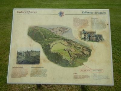
Outer Defences / Défenses avancées
Gaillardin Redoubt
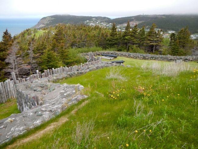
Built originally of logs and subsequently of drywall masonry, this small enclosure surrounded by a breastwork was intended to keep an enemy from taking possession of Gaillardia Mountain, which overlooked Fort Louis and the town. Embrasures in the walls enabled soldiers to fire at attacking enemy. In 1799, it boasted an armament of six cannons.
Breastwork
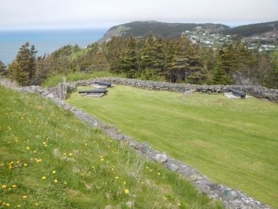
The low stone walls surrounding Fort Royal are called breastworks. Built as an outer defence perimeter for the fort, they were originally accompanied by a wooden palisade. The upper part of the hill was cleared of trees to enable soldiers to fire at an approaching enemy from the protection of this wall. If the enemy threatened to overrun the breastwork, the soldiers would retreat to the fort.
Glacis
The sloping ground outside the walls of Fort Royal is known as the glacis. Within this area, an enemy attacker was exposed to musket fire from the fort.
French
Redoute du gaillardin
Construit de rondins à l’origine, puis de maçonnerie, ce petit fortin entouré d’un épaulement devait empêcher l’ennemi de s’emparer du mont Gaillardin, qui dominait le fort Louis et la ville. Ses murs troués d’embrasures permettaient aux occupants de tirer sur les ennemis. En 1709, le redoute était armée de six canons.
Épaulement
Les murets de pierres qui entourent le fort Royal s’appellent des épaulements. Édifiés pour servir de périmètre de défense avancée au fort, ils étaient à l’époque épaulés d’une palissade de rondins . Le sommet de la colline était déboisé pour permettre aux soldats de tirer sur les assaillants de derrière ce mur. Si l’ennemi menaçait de prendre l’épaulement, les soldats pouvaient battre un retraite dans le fort.
Glacis
Le talus situé à l’extérieur des murailles du fort Royal était appelé glacis. Dans cette zone, l’assaillant était exposé aux tirs de mousquet du fort.
Erected by Parks Canada.
Topics. This historical marker is listed in this topic list: Forts and Castles. A significant historical year for this entry is 1799.
Location. 47° 15.065′ N, 53° 58.279′ W. Marker is in Placentia, Newfoundland and Labrador, in Avalon Peninsula, Newfoundland. Marker can be reached from Castle Hill Road. Touch for map. Marker is in this post office area: Placentia NL A0B, Canada. Touch for directions.
Other nearby markers. At least 5 other markers are within walking distance of this marker. Port Royal and Castle Graves (a few steps from this marker); Fort Royal (Plaisance) (a few steps from this marker); Castle Hill (about 90 meters away, measured in a direct line); a different marker also named Castle Hill (about 90 meters away); Fort Frederick (approx. 0.8 kilometers away).
More about this marker. This maker is on the grounds of Castle Hill National Historic Site.
Credits. This page was last revised on June 16, 2016. It was originally submitted on November 17, 2014, by Barry Swackhamer of Brentwood, California. This page has been viewed 461 times since then and 38 times this year. Photos: 1, 2, 3. submitted on November 17, 2014, by Barry Swackhamer of Brentwood, California. • Andrew Ruppenstein was the editor who published this page.


