St. John's in Avalon Peninsula, Newfoundland, Newfoundland and Labrador — The Atlantic Provinces (North America)
1892: The Great Fire
1892: Le grand incendie
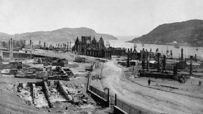
Caption, top, right (English / French): During the night of July 8/9, 1892 more than 1,700 buildings in the heart of St. John’s were destroyed by fire. The blaze left 1,900 families homeless, but miraculously claimed only two lives. / Dans la nuit de 8 au 9 juillet 1892, plus de 1 700 édifices de centre-ville de St. John’s furent ravagés par le feu. La conflagration, qui laissa quelque 1 900 familles sans foyer, ne fit miraculeusement que deux victimes.
Topics. This historical marker is listed in this topic list: Disasters. A significant historical date for this entry is July 8, 1870.
Location. 47° 34.196′ N, 52° 40.94′ W. Marker is in St. John's, Newfoundland and Labrador, in Avalon Peninsula, Newfoundland. Marker can be reached from Signal Hill Road. Touch for map. Marker is in this post office area: St John's NL A1A, Canada. Touch for directions.
Other nearby markers. At least 8 other markers are within walking distance of this marker. Noon Day Gun (a few steps from this marker); Swiling (within shouting distance of this marker); Fishery (within shouting distance of this marker); Ice (within shouting distance of this marker); Peacetime Use (within shouting distance of this marker); Cabot Tower (within shouting distance of this marker); Battle of Signal Hill (within shouting distance of this marker); Transatlantic Radio Signals (about 90 meters away, measured in a direct line). Touch for a list and map of all markers in St. John's.
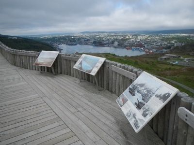
More about this marker. This marker is located at the Saint John's overlook in Signal Hill National Historic Site.
Also see . . . The St. John's Fire of 1892 - Heritage Newfoundland. Sizeable donations also poured in from Canada, Great Britain, and the United States. Newfoundland and Labrador Governor T.N. O’Brien was vacationing in England at the time of the fire and managed to raise $113,705 in public donations; the British government also gave $72,000. A group of Newfoundland expatriates living in Boston, Massachusetts launched a successful fundraising campaign there, which earned the Fire Relief Committee an additional $16,000. (Submitted on November 20, 2014, by Barry Swackhamer of Brentwood, California.)
Photographed By Barry Swackhamer, June 22, 2014
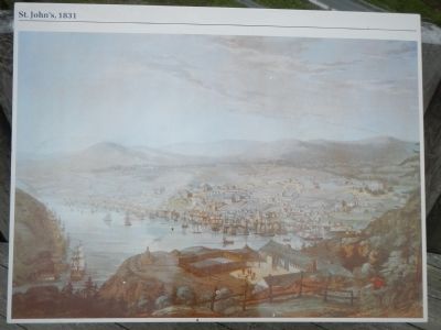
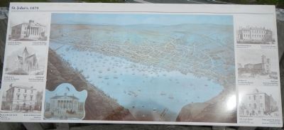
6. St. John’s, 1879
An adjacent panel.
Captions on left, top to bottom (English / French): Colonial Building: Constructed 1847-50 / Colonial Building: construite de 1847 à 1850; Cathedral of St. John the Baptist: Constructed 1847-50 / Cathédrale Saint-Jean-Baptiste: construite de 1847 à 1850; Bank of British North America: Constructed 1848 / Bank of British North America: construite en 1848.
Captions on right, top to bottom (English / French): Government House: Constructed 1827-31 / Government House: construite de 1827 à 1831; Basilica of St. John the Baptist: Constructed 1841-55 / Basilique Saint-Jean-Baptiste: construite de 1841 à 1853; Old Court House: Constructed 1847 (Destroyed by fire 1892) / Vieux place de justice: construite en 1847 (détruit par l’incendie de 1892).
Credits. This page was last revised on June 16, 2016. It was originally submitted on November 20, 2014, by Barry Swackhamer of Brentwood, California. This page has been viewed 553 times since then and 48 times this year. Photos: 1, 2, 3, 4, 5, 6. submitted on November 20, 2014, by Barry Swackhamer of Brentwood, California. • Andrew Ruppenstein was the editor who published this page.

