Sylmar in Los Angeles in Los Angeles County, California — The American West (Pacific Coastal)
Loop Fire
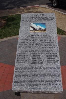
This park and memorial stand as a tribute to the young men who lost their lives on the Loop Fire, to those who survived, and to firefighters everywhere.
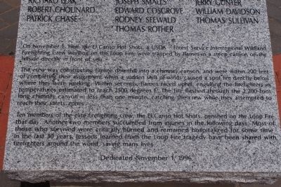
On November 1, 1966, the El Cariso Hot Shots, a USDA Forest Service Interregional Wildland Firefighting Crew working on the Loop Fire were trapped by flames in a steep canyon on a hillside directly in front of you.
The crew was constructing fireline downhill into a chimney canyon and were within 200 feet of completing their assignment when a sudden shift of winds caused a spot fire directly below where they were working. Within seconds, flames raced uphill, engulfing the firefighters in temperatures estimated to reach 2500 degree F. The fire flashed through the 2,200 foot chimney canyon in less than one minute, catching the crew while they attempted to reach their safety zones.
Ten members of the elite firefighting crew, the El Cariso Hot Shots, perished on the Loop Fire that day. Another two members succumbed from injuries in the following days. Most of those who survived were critically burned and remained hospitalized for some time. In the last 30 years, lessons learned from the Loop Fire tragedy have been shared with firefighters around the world, saving many lives.
Dedicated November 1, 1996
Erected 1996.
Topics. This historical marker is listed in these topic lists: Disasters • Horticulture & Forestry. A significant historical month for this entry is November 1966.
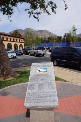
Location. 34° 18.986′ N, 118° 25.048′ W. Marker is in Los Angeles, California, in Los Angeles County. It is in Sylmar. Marker can be reached from Hubbard Street, 0.8 miles east of Interstate 210. Entering El Cariso Community Regional Park, drive south to the Community Center. Parking near the sw corner of the building walk 200 feet se to the marker location. Touch for map. Marker is at or near this postal address: 13100 Hubbard Street, Sylmar CA 91342, United States of America. Touch for directions.
Other nearby markers. At least 8 other markers are within 3 miles of this marker, measured as the crow flies. 1971 Sylmar Earthquake (approx. 0.6 miles away); The San Fernando Pioneer Memorial Cemetery (approx. 1.8 miles away); The Griffith Ranch (approx. 1.9 miles away); Rogerio Rocha (approx. 2.1 miles away); Glen Haven Veterans Memorial (approx. 2.4 miles away); Mission Wells (approx. 2.7 miles away); Cesar Chαvez (approx. 2.8 miles away); Casa de Lopez (approx. 2.8 miles away). Touch for a list and map of all markers in Los Angeles.
Also see . . . Loop Fire. Wikipedia entry (Submitted on January 4, 2024, by Larry Gertner of New York, New York.)
Additional keywords. hot shot,hotshot,El Cariso,wildland fire,fatality,10 and 18,Standard Firefighting Orders,Watchout Situations
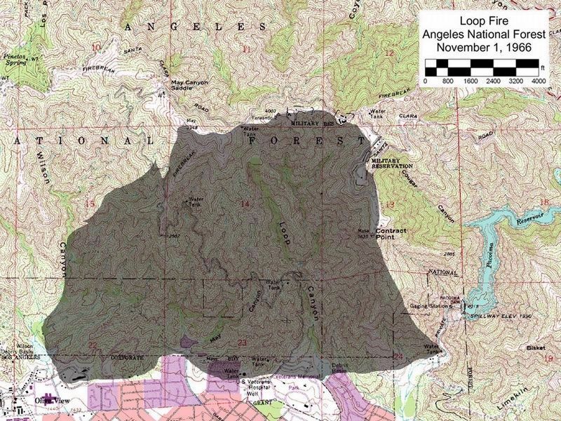
via National Wildfire Coordinating Group, unknown
3. Loop Fire Staff Ride.
National Wildfire Coordinating Group website entry:
Staff Rides are tools for educating crew leaders and firefighters about what happened in specific situations.
Click for more information.
Staff Rides are tools for educating crew leaders and firefighters about what happened in specific situations.
Click for more information.
Credits. This page was last revised on January 4, 2024. It was originally submitted on April 1, 2014, by Chris English of Phoenix, Arizona. This page has been viewed 1,634 times since then and 92 times this year. Last updated on November 26, 2014, by James King of San Miguel, California. Photos: 1, 2. submitted on April 1, 2014, by Chris English of Phoenix, Arizona. 3. submitted on January 4, 2024, by Larry Gertner of New York, New York. 4. submitted on April 1, 2014, by Chris English of Phoenix, Arizona. 5. submitted on February 5, 2018, by Craig Baker of Sylmar, California. • Andrew Ruppenstein was the editor who published this page.
