West Front Street
Thruway to the State House
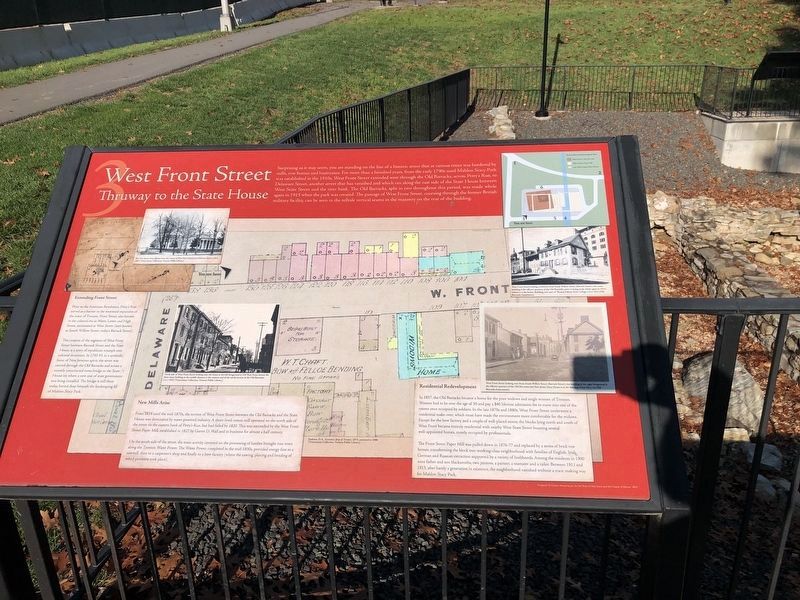
Extending Front Street
Prior to the American Revolution, Petty's Run served as a barrier to the westward expansion of the town of Trenton. Front Street, also known in the colonial era as Water, Lower and High Street, terminated at West Street (later known as South Willow Street; today's Barrack Street).
The creation of the segment of West Front Street between Barrack
this page online
New Mills Arise
From 1814 until the mid-1870s, the section of West Front Street between the Old Barracks and the State House was dominated by water-powered industry. A short-lived cotton mill operated on the north side of the street on the eastern bank of Petty's Run, but had failed by 1820. This was succeeded by the West Front Street Paper Mill, established in 1827 by Garrett D. Wall and in business for almost a half century.
On the south side of the street, the main activity centered on the processing of lumber brought into town along the Trenton Water Power. The Water Power, completed in the mid-1830s, provided energy first to a sawmill, then to a carpenter's shop and finally to a bow factory (where the sawing, planing and bending
Residential Redevelopment
In 1857, the Old Barracks became a home for the poor widows and single women of Trenton. Women had to be over the age of 50 and pay a $40 lifetime admission fee to move into one of the rooms once occupied by soldiers. In the late 1870s and 1880s, West Front Street underwent a residential make-over, which must have made the environment more comfortable for the widows. Except for the bow factory and a couple of well-placed stores, the blocks lying north oand south of West Front became entirely residential with nearby West State Street boasting several well-appointed homes, mostly occupied by professionals.
The Front Street Paper Mill was pulled down in 1876-77 and replaced by a series of brick row homes, transforming the block into working-class neighborhood with families of English, Irish, German and Russian extraction supported by a variety of livelihoods. Among the residents in 1900 were father a son blacksmiths, two janitors, a painter, a teamster and a tailor. Between 1911 and 1913, after barely a generation of existence, the neighborhood vanished without a trace, making way
Photo at top right
West Front Street looking northwest from South Willow Street (Barrack Street); the stone building is the officers' quarters of the Old Barracks, prior to being made whole again in 1915; behind it is the Kelsey Building, now part of Thomas Edison State College. Circa 1911 (Old Barracks Association).
Center Photo
North side of West Front Street looking east; the home in the left foreground is 124 West Front Street; the three-story building in the middle distance is the western end of the north section of the Old Barracks. Circa 1910 (Trentoniana Collection, Trenton Public Library).
Photo bottom right
West Front Street looking west from South Willow Street (Barrack Street); the building in the right foreground is the officers' quarters of the Old Barracks; the New Jersey State House is in the distance. Circa 1911-13 (Old Barracks Association).
Erected by Petty's Run Archaeological Site. (Marker Number 3.)
Topics. This historical marker is listed in this topic list: Notable Places. A significant historical year for this entry is 1915.
Location. 40° 13.209′ N, 74° 46.16′ W. Marker is in Trenton,

Regionally, this marker is in Central Jersey and in Greater Princeton. It is also in the American Northeast and in the Mid-Atlantic. Globally, it is in North America, the Western Hemisphere, the Western World, and the Anglosphere. Historically, it finds itself in what was once New Netherland and also one of the original Thirteen Colonies.
Other nearby markers. At least 8 other markers are within walking distance of this marker: Front Street Paper Mill (a few steps from this marker); The Trenton Steel Works (a few steps from this marker); Petty's Run (a few steps from this marker); a different marker also named Petty's Run (within shouting distance of this marker); Changing Landscapes Along Petty's Run (within shouting distance of this marker); Isaac Harrow’s Plating and Blade Mill (within shouting distance of this marker); State House (within shouting distance of this marker); The Story of Trenton (within shouting distance of this marker). Touch for a list and map of all markers in Trenton.
Credits. This page was last revised on February 16, 2023. It was originally submitted on December 3, 2014, by Bill Pfingsten of Bel Air, Maryland. This page has been viewed 582 times since then and 38 times this year. Photos: 1. submitted on November 15, 2020, by Devry Becker Jones of Washington, District of Columbia. 2, 3. submitted on December 2, 2018, by Bill Coughlin of Woodland Park, New Jersey. 4. submitted on December 3, 2014, by Bill Pfingsten of Bel Air, Maryland.
