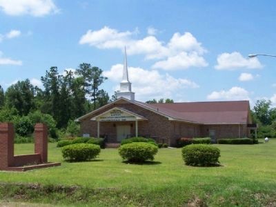
Guyton in Effingham County, Georgia — The American South (South Atlantic)
Pilgrim Missionary Baptist Normal and Industrial Institute
Inscription.
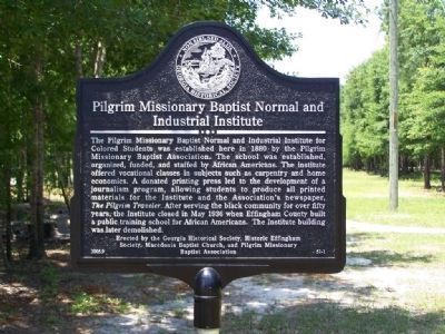
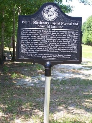
The Pilgrim Missionary Baptist Normal and Industrial Institute for Colored Students was established here in 1880 by the Pilgrim Missionary Baptist Association. The school was established, organized, funded and staffed by African Americans. The institute
offered vocational classes in subjects such as carpentry and home economics. A donated printing press led to the development of a journalism program, allowing students to produce all printed materials for the Institute and the Association's newspaper,
The Pilgrim Traveler. After serving the black community for over fifty years, the Institute closed in May 1936 when Effingham County built a public training school for African Americans. The
Institute building was later demolished.
Erected 2005 by Georgia Historical Society, Historic Effingham Society, Macedonia Baptist Church, and Pilgrim Missionary Baptist Association. (Marker Number 51-1.)
Topics and series. This historical marker is listed in these topic lists: African Americans • Charity & Public Work • Churches & Religion • Education. In addition, it is included in the Georgia Historical Society series list. A significant historical month for this entry is May 1936.
Location. 32° 20.583′ N, 81° 23.947′ W. Marker is in Guyton, Georgia, in Effingham County. Marker is on Central Boulevard (Georgia Route 17) near Simmons Street, on the left when traveling north. Touch for map. Marker is in this post office area: Guyton GA 31312, United States of America. Touch for directions.
Other nearby markers. At least 8 other markers are within 6 miles of this marker, measured as the crow flies. Guyton Confederate General Hospital (approx. 0.9 miles away); Camp Davis, Military Instructional Camp, C.S.A. (approx. 1.7 miles away); Springfield Central High School (approx. 4.7 miles away); Effingham County (approx. 5.4 miles away); Effingham County Veterans Memorial (approx. 5.4 miles away); Confederate Memorial (approx. 5.4 miles away); Sherman's Left Wing (approx. 5˝ miles away); Effingham County Methodist Camp Ground (approx. 5.7 miles away). Touch for a list and map of all markers in Guyton.
Credits. This page was last revised on March 28, 2024. It was originally submitted on May 27, 2008, by Mike Stroud of Bluffton, South Carolina. This page has been viewed 2,245 times since then and 55 times this year. Photos: 1, 2, 3, 4, 5. submitted on May 27, 2008, by Mike Stroud of Bluffton, South Carolina. • Christopher Busta-Peck was the editor who published this page.
