Sally's Cove in Great Northern Peninsula, Newfoundland, Newfoundland and Labrador — The Atlantic Provinces (North America)
Green Point
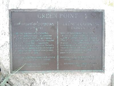
Cambrian-Ordovician Boundary / La limite Cambrien-Ordovicien
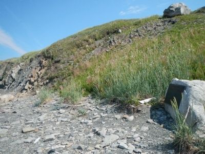
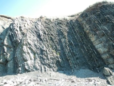
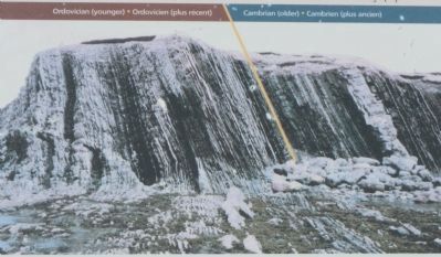
In 2000, the global stratotype for the boundary between the Cambrian and Ordovician systems was designated here at Green Point by the International Commission of Stratigraphy. It is located within a bed of shale and limestone (Bed 23) exposed in the southwest facing cliff and shore platform. The level is marked by the first appearance of the conodont fossil Iapetognathus fluctivagus, 4.8 meters below the oldest known planktic graptolite fossils.
The site lies within Gros Morne National Park. No collecting or scientific study is allowed without a permit.
French:
En l’an 2000, la Commission internationale de stratigraphie a localisé ici, à Green Point, le stratotype global de la limite entre les systèmes cambrien et ordovicien. Cette limite apparaît dans un lit de shale et de calcaire (Lit 23) affleurant sur le platier et dans la falaise exposés au sud-ouest. Elle correspond à l’apparition d’un fossile, le conodonte Iapetognathus fluctivagus, à 4,8 mètres au-dessous de plus anciens graptolites pélagiques fossiles connus.
Le site fait partie du parc national du Gros-Morne. Prélèvement et études scientifiques interdits sans autorisation.
Erected by Subcommission on Ordovician Stratigraphy & Parks Canada.
Topics. This historical marker is listed in this topic list: Paleontology. A significant historical year for this entry is 2000.
Location. 49° 40.936′ N, 57° 57.853′ W. Marker is in Sally's Cove, Newfoundland and Labrador, in Great Northern Peninsula, Newfoundland. Marker can be reached from unnamed road close to Newfoundland and Labrador Route 430. Touch for map. Marker is in this post office area: Sally's Cove NL A0K 4Z0, Canada. Touch for directions.
More about this marker. This marker is on the beach near the end of an unnamed road leading west from Newfoundland Highway 430. Green Point is in Gros Morne National Park, south of Sally's Cove,
Credits. This page was last revised on July 6, 2020. It was originally submitted on December 14, 2014, by Barry Swackhamer of Brentwood, California. This page has been viewed 479 times since then and 30 times this year. Photos: 1, 2, 3, 4. submitted on December 14, 2014, by Barry Swackhamer of Brentwood, California. • Andrew Ruppenstein was the editor who published this page.


