Beaverdam in Hanover County, Virginia — The American South (Mid-Atlantic)
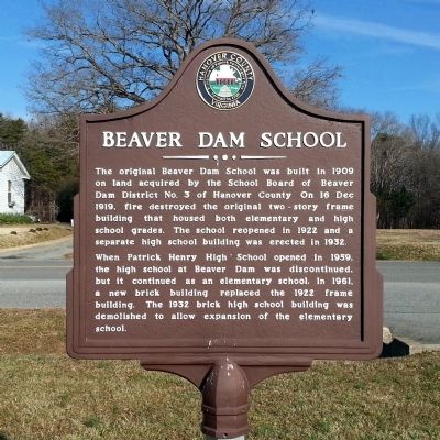
Beaver Dam School
The original Beaver Dam School was built in 1909 on land acquired by the School Board of Beaver Dam District No. 3 of Hanover County. On 16 Dec 1919, fire destroyed the original two-story frame building that housed both elementary and high school grades. The school reopened in 1922 and a separate high school building was erected in 1932.
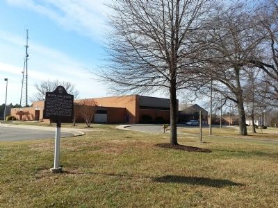
When Patrick Henry High School opened in 1959, the high school at Beaver Dam was discontinued, but it continued as an elementary school. In 1961, a new brick building replaced the 1922 frame building. The 1932 brick high school building was demolished to allow expansion of the elementary school.
Erected 2014 by Hanover County.
Topics. This historical marker is listed in this topic list: Education. A significant historical date for this entry is December 16, 1919.
Location. 37° 56.023′ N, 77° 38.47′ W. Marker is in Beaverdam, Virginia, in Hanover County. Marker is on Beaverdam School Road (Virginia Route 739) east of Halls Hideaway Lane, on the right when traveling east. Touch for map. Marker is at or near this postal address: 15485 Beaverdam School Rd, Beaverdam VA 23015, United States of America. Touch for directions.
Other nearby markers. At least 8 other markers are within 8 miles of this marker, measured as the crow flies. The Depot at Beaver Dam (approx. 0.9 miles away); William Clark Birthplace (approx. 5.6 miles away); Bumpass (approx. 5.6 miles away); Scotchtown (approx. 6.9 miles away); Cedar Creek Quaker Meeting House (approx. 7.6 miles away); Jerdone Castle (approx. 7.7 miles away); a different marker also named Scotchtown (approx. 7.8 miles away); Sycamore Tavern (approx. 8.1 miles away). Touch for a list and map of all markers in Beaverdam.
Credits. This page was last revised on April 17, 2022. It was originally submitted on December 31, 2014, by Bernard Fisher of Richmond, Virginia. This page has been viewed 669 times since then and 70 times this year. Photos: 1, 2. submitted on December 31, 2014, by Bernard Fisher of Richmond, Virginia.

