Haute-Ville in Québec in Communauté-Urbaine-de-Québec, — Central Canada (French-Canadian)
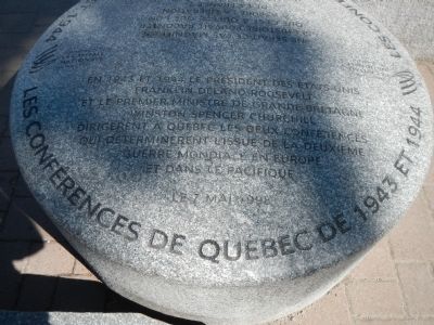
Les Conferences de Québec de 1943 et 1944
The Québec Conferences of 1943 and 1944
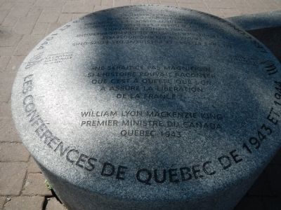
Ne serait ce pas magnifique si l’histoire pouvait raconter que c’est à Québec que l’on a assure la liberation de la France?»
William Lyon MacKenzie King
Premier ministre du Canada
Québec 1943
English translation:
Would not it be beautiful if history could say that it was in Quebec that we ensure the liberation of France? "
William Lyon MacKenzie King
Prime Minister of Canada | Quebec 1943
Erected 1998 by Commission de la capitale du Québec.
Topics and series. This historical marker is listed in this topic list: War, World II. In addition, it is included in the Former U.S. Presidents: #32 Franklin D. Roosevelt series list. A significant historical year for this entry is 1943.
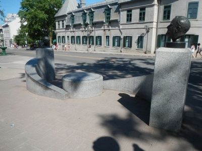
Location. 46° 48.58′ N, 71° 12.661′ W. Marker is in Québec, in Communauté-Urbaine-de-Québec. It is in Haute-Ville. Marker is on Rue Saint Louis close to Côte de la Citadelle, on the right when traveling west. Touch for map. Marker is at or near this postal address: 114 Rue Saint Louis, Québec G1R 3Z7, Canada. Touch for directions.
Other nearby markers. At least 8 other markers are within walking distance of this marker. Quebec Boer War Memorial (within shouting distance of this marker); The Québec Garrison Club (within shouting distance of this marker); Fortifications de / of Québec (within shouting distance of this marker); Jonathan Sewell (within shouting distance of this marker); General Montgomery’s Army (within shouting distance of this marker); Augustin-Norbert Morin (about 90 meters away, measured in a direct line); Frontenac (about 90 meters away); In Memory of Our Fallen Soldiers (about 120 meters away). Touch for a list and map of all markers in Québec.
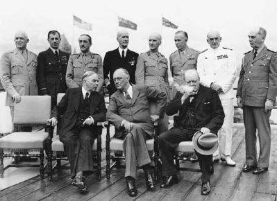
Also see . . . Québec Conferences 1943, 1944 - The Canadian Encyclopedia. The Québec conferences were two in a series of high-level strategic meetings held by Allied leaders during World War II. The first took place from 10 to 24 August 1943, and the second from 11 to 16 September 1944. The meetings, at which the future course of the war was planned, were dominated by Winston Churchill and Franklin Delano Roosevelt, except at Yalta, where Josef Stalin was an equal partner. (Submitted on February 10, 2015, by Barry Swackhamer of Brentwood, California.)
Credits. This page was last revised on February 9, 2023. It was originally submitted on February 10, 2015, by Barry Swackhamer of Brentwood, California. This page has been viewed 357 times since then and 21 times this year. Photos: 1, 2, 3, 4. submitted on February 10, 2015, by Barry Swackhamer of Brentwood, California. • Andrew Ruppenstein was the editor who published this page.


