St. Albans in Kanawha County, West Virginia — The American South (Appalachia)
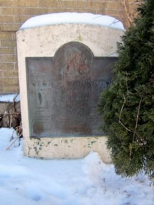
George Washington
Acquired 2,000 acres of this land by a patent dated April 12, 1784, issued to him by Benjamin Harrison, Governor of Virginia.
Washington obtained this tract upon a survey made by John Floyd, April 18, 1784 with a land warrant issued to Charles Mynn Thurston, a Lieutenant in the French and Indian War. It bordered on the Great Kanawha and Coal Rivers, five miles and eighty eight poles.
Erected 1932 by The State of West Virginia.
Topics and series. This historical marker is listed in this topic list: Settlements & Settlers. In addition, it is included in the Former U.S. Presidents: #01 George Washington series list. A significant historical date for this entry is April 12, 1784.
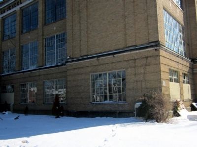
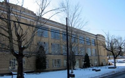
Location. 38° 22.911′ N, 81° 49.628′ W. Marker is in St. Albans, West Virginia, in Kanawha County. Marker is at the intersection of Kanawha Terrace and Lee Street, on the right when traveling east on Kanawha Terrace. Located at the northwest corner of the old St. Albans Junior High School. Touch for map. Marker is in this post office area: Saint Albans WV 25177, United States of America. Touch for directions.
Other nearby markers. At least 8 other markers are within one mile of this marker, measured as the crow flies. Washington's Land (approx. half a mile away); Old St. Albans Post Office (approx. 0.6 miles away); First Baptist Church (approx. 0.6 miles away); St. Albans Covered Bridge (approx. ¾ mile away); St. Mark's Episcopal Church (approx. ¾ mile away); Birkett Davenport Fry (approx. 0.9 miles away); World War I Memorial (approx. 0.9 miles away); St. Albans Archeological Site (approx. one mile away). Touch for a list and map of all markers in St. Albans.
Credits. This page was last revised on December 25, 2023. It was originally submitted on March 13, 2015, by Bernard Fisher of Richmond, Virginia. This page has been viewed 505 times since then and 37 times this year. Last updated on December 7, 2023, by Carl Gordon Moore Jr. of North East, Maryland. Photos: 1, 2, 3. submitted on March 13, 2015, by Bernard Fisher of Richmond, Virginia. • Devry Becker Jones was the editor who published this page.


