Vieux-Québec-Cap-Blanc-colline Parlementaire in Communauté-Urbaine-de-Québec, — Central Canada (French-Canadian)
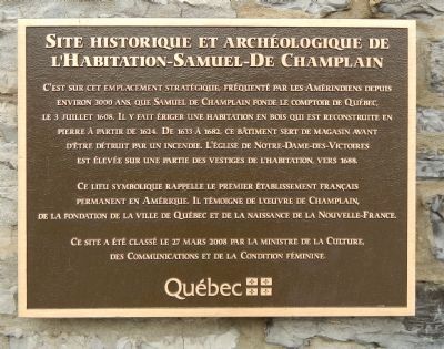
Site historique et archéologique de l’Habitation-Samuel-De Champlain
Inscription.
French:
Ce lieu symbolique rappelle le premier établissement français permanent en Amérique. Il témoigne de l’oeuvre de Champlain, de la fondation de la ville de Québec et de la naissance de la Nouvelle-France.
Ce site a été classé le 27 mars 2008 par la ministre de la Culture, des Communications et de la Condition féminine.
English translation:
It is on this strategic location, frequented by Native Americans for about 3000 years,that Samuel de Champlain found the Quebec tableland, July 3, 1608. He erected a wooden home that was rebuilt in stone from 1724. From 1633 to 1682, the building serves as a storehouse before being destroyed by fire. The church of Notre-Dame-des-Victoires was built on part of the house remains, about 1688.
This symbolic place recalls the first permanent French settlement in America. It reflects the work of Champlain, the founding of Quebec City and the birth of New France.
This site was classified 27 March 2008 by the Minister of Culture, Communications and the Status of Women.
Erected 2008 by Minister of Culture, Communications and the Status of Women.
Topics. This historical marker is listed in this topic list: Settlements & Settlers. A significant historical date for this entry is March 27, 2008.
Location. 46° 48.778′ N, 71° 12.168′ W. Marker is in Québec, in Communauté-Urbaine-de-Québec. It is in Vieux-Québec-Cap-Blanc-colline Parlementaire. Marker is on Rue Notre Dame, on the left when traveling south. Touch for map. Marker is at or near this postal address: 26 Rue Notre Dame, Québec G1K, Canada. Touch for directions.
Other nearby markers. At least 8 other markers are within walking distance of this marker. Notre-Dame-des-Victoires (a few steps from this marker); Pierre Dugua de Mons (a few steps from this marker); L'Église Notre-Dame-des-Victoires Church (within shouting distance of this marker); Trois façons de se chauffer / Three Modes of Heating (within shouting distance of this marker); Le premier monastère d’Ursulines (within shouting distance of this marker); Les filles du roy (within shouting distance of this marker); Mathieu d'Amours (within shouting distance of this marker); Charles Campagna (within shouting distance of this marker). Touch for a list and map of all markers in Québec.
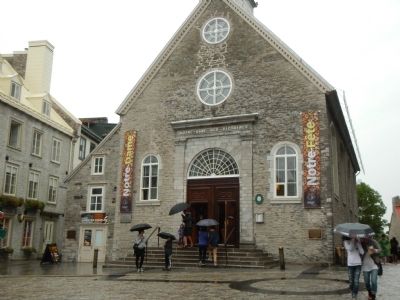
More about this marker. This marker is on the façade of the Notre-Dame-des-Victories church in Place Royale.
Credits. This page was last revised on February 9, 2023. It was originally submitted on March 15, 2015, by Barry Swackhamer of Brentwood, California. This page has been viewed 629 times since then and 57 times this year. Photos: 1, 2. submitted on March 15, 2015, by Barry Swackhamer of Brentwood, California. • Andrew Ruppenstein was the editor who published this page.

