Wissahickon Valley Park in Philadelphia in Philadelphia County, Pennsylvania — The American Northeast (Mid-Atlantic)
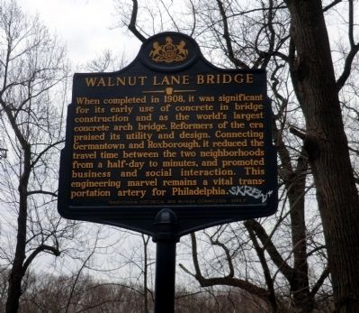
Walnut Lane Bridge
Erected 2008 by Pennsylvania Historical & Museum Commission.
Topics and series. This historical marker is listed in this topic list: Bridges & Viaducts. In addition, it is included in the Pennsylvania Historical and Museum Commission series list. A significant historical year for this entry is 1908.
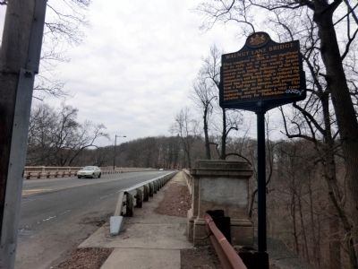
Location. 40° 1.974′ N, 75° 11.952′ W. Marker is in Philadelphia, Pennsylvania, in Philadelphia County. It is in Wissahickon Valley Park. Marker is on Walnut Lane. NE side of bridge over Wissahickon Creek (Germantown side). Touch for map. Marker is in this post office area: Philadelphia PA 19144, United States of America. Touch for directions.
Other nearby markers. At least 8 other markers are within walking distance of this marker. A different marker also named Walnut Lane Bridge (about 600 feet away, measured in a direct line); Forbidden Drive (approx. half a mile away); Battle of Germantown (approx. half a mile away); a different marker also named Battle of Germantown (approx. half a mile away); The Jacob Rittenhouse Home at RittenhouseTown (approx. half a mile away); Ten Box Shelter (approx. half a mile away); Connie Mack (approx. half a mile away); Kelpius Community (approx. half a mile away). Touch for a list and map of all markers in Philadelphia.

Photographed By Don Morfe, March 24, 2015
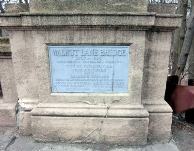
3. Walnut Lane Bridge 1907-1908
Total Length 610 ft. Main Span 233 ft. Height 147 ft. City of Philadelphia, John E. Reyburn, Mayor. George R. Stearns, Director of the Department of Public Works; George S. Webster, Chief Engineer; Henry H. Quimby, Assistant Engineer; Reilly and Riddle, Contractors.
Credits. This page was last revised on February 2, 2023. It was originally submitted on March 29, 2015, by Don Morfe of Baltimore, Maryland. This page has been viewed 292 times since then and 10 times this year. Photos: 1, 2, 3. submitted on March 29, 2015, by Don Morfe of Baltimore, Maryland. • Bill Pfingsten was the editor who published this page.

