Morrisburg in Stormont Dundas and Glengarry United Counties, Ontario — Central Canada (North America)
Battle of Crysler’s Farm
Bataille de la ferme Crysler
Photographed by Barry Swackhamer, August 6, 2014
1. Battle of Crysler’s Farm Marker
English:
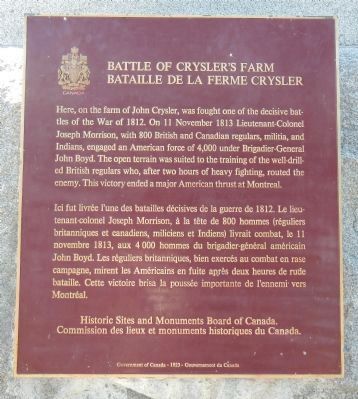
Here, on the farm of John Crysler, was fought one of the decisive battles of the War of 1812. On 11 November 1813 Lieutenant-Colonel Joseph Morrison, with 800 British and Canadian regulars, militia and Indians, engaged an American force of 4,000 under Brigadier-General John Boyd. The open terrain was suited to the training of the well-drilled British regulars, who, after two hours of heavy fighting, routed the enemy. This victory ended a major American thrust at Montreal.
French:
Ici fut livrée l'une des batailles décisives de la guerre de 1812. Le lieutenant-colonel Joseph Morrison, à la tête de 800 hommes (réguliers britanniques et canadiens, miliciens et Indiens) livrait combat, le 11 novembre 1813, aux 4 000 hommes du brigadier-général américain John Boyd. Les réguliers britanniques, bien exercés au combat en rase compagne, mirent les Américains en fuite après deux heures de rude bataille. Cette victoire brisa la poussée importante de l'ennemi vers Montréal.
Erected 1923 by Historic Sites and Monument Board of Canada/Commission de lieux et monuments historique du Canada.
Topics and series.
this page online
Location. 44° 56.516′ N, 75° 4.212′ W. Marker is in Morrisburg, Ontario, in Stormont Dundas and Glengarry United Counties. It can be reached from Stormont, Dundas and Glengarry County Road (County Route 2) near Upper Canada Village, on the left when traveling west. Touch for map. Marker is at or near this postal address: 13700 Stormont Dundas and Glengarry County Road, Morrisburg ON K0C 1M0, Canada. Touch for directions.

Regionally, this marker is in Eastern Ontario. It is also in Central Canada. Globally, it is in North America, the Western Hemisphere, the Western World, and the Anglosphere. Historically, it finds itself in what was once a British colony, the Viceroyalty of New France, the Haudenosaunee (Iroquois) Confederacy, and Rupert’s Land.
Other nearby markers. At least 8 other markers are within walking distance of this marker: Battlefield of Crysler’s Farm (about 120 meters away, measured in a direct line);
Photographed by Barry Swackhamer, August 6, 2014
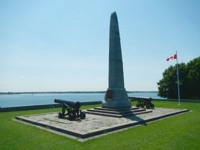
2. Battle of Crysler’s Farm Marker
Photographed by Barry Swackhamer, August 6, 2014
3. Battle of Crysler’s Farm Monument
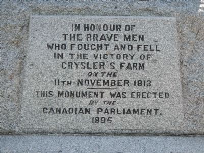
The Brave Men
who fought and fell
in the victory of
Crysler’s Farm
on the 11th November 1813
This monument was erected
by the
Canadian Parliament
1895
Photographed by Barry Swackhamer, August 6, 2014
4. Battle of Crysler’s Farm Monument
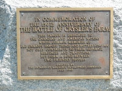
the 150th anniversary of
The Battle of Crysler’s Farm
This plaque is dedicated to the Canadian and American nations whose common memories of “old unhappy far-off things and battles long ago” not only contribute to their separate heritages and traditions but form a bond between two friendly peoples
Erected by
The Ontario-St. Lawrence Development Commission
July 1963
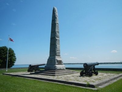
Photographed by Barry Swackhamer, August 6, 2014
5. Battle of Crysler’s Farm Monument
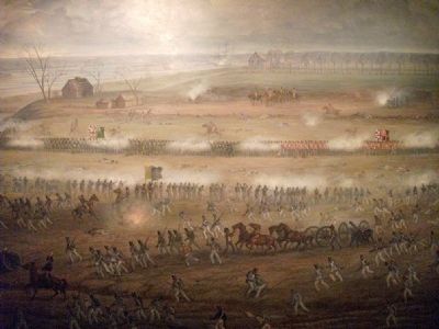
Photographed by Parks Canada, July 8, 2011
6. Battle of Crysler’s Farm Marker
Mural by Adam Sherriff-Scotts.
Credits. This page was last revised on March 31, 2025. It was originally submitted on April 6, 2015, by Barry Swackhamer of Brentwood, California. This page has been viewed 913 times since then and 47 times this year. Photos: 1, 2, 3, 4, 5, 6. submitted on April 6, 2015, by Barry Swackhamer of Brentwood, California. • Andrew Ruppenstein was the editor who published this page.
