Near Brackettville in Kinney County, Texas — The American South (West South Central)
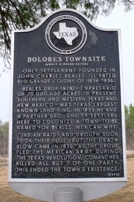
Dolores Townsite
(About 8 miles south)
Only settlement founded in John Charles Beales' ill-fated Rio Grande colony of 1834-1836. Beales (1804-1878) -- empresario of 70,000,000 acres in present Southern and Western Texas and New Mexico -- was Texas' largest known land king. In 1833 he and a partner brought 59 settlers here to colonize a town to be named for Beales' Mexican wife. Indian raids and drought soon took their toll, but the death blow came in 1836. As the group fled the Mexican Army during the Texas Revolution, Comanches killed all but 7 of one party. This ended the town's existence.
Erected 1970 by State Historical Survey Committee. (Marker Number 1243.)
Topics and series. This historical marker is listed in these topic lists: Settlements & Settlers • War, Texas Independence. In addition, it is included in the San Antonio-El Paso Road series list. A significant historical year for this entry is 1833.
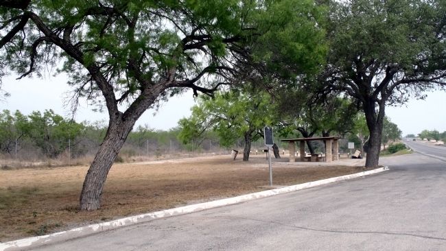
Location. 29° 20.15′ N, 100° 32.114′ W. Marker is near Brackettville, Texas, in Kinney County. Marker is on U.S. 90, on the right when traveling west. This marker is just west of Pinto Creek at a roadside rest where it is comfortably and safely accessible. Touch for map. Marker is in this post office area: Brackettville TX 78832, United States of America. Touch for directions.
Other nearby markers. At least 8 other markers are within 8 miles of this marker, measured as the crow flies. U.S. Army Signal Corps Building (approx. 7 miles away); Staff Officers' Quarters (approx. 7 miles away); Carver School Grounds (approx. 7 miles away); Adjutant's Quarters (Quarters #20) (approx. 7.1 miles away); Seminole Indian Scouts' Cemetery (approx. 7.1 miles away); Commanding Officer's Quarters (approx. 7.1 miles away); Las Moras Spring (approx. 7.1 miles away); Officers' Row Quarters (approx. 7.1 miles away). Touch for a list and map of all markers in Brackettville.
More about this marker. The location of the marker has its own historical significance. Long before this site became a Texas Highway Department picnic area it was a regular overnight stop in the 1850s for wagon trains enroute to California on the Lower Military Road across west Texas. Many a traveler drank here from the cool waters of Pinto Creek.
Regarding Dolores Townsite. The sparse remains of the Dolores townsite are on private land aside Las Moras Creek about 8 miles southeast of the rest area. Only a few outlines of stone foundations are still visible.
Credits. This page was last revised on November 27, 2020. It was originally submitted on April 19, 2013, by William F Haenn of Fort Clark (Brackettville), Texas. This page has been viewed 875 times since then and 80 times this year. Last updated on April 20, 2015, by J. Makali Bruton of Accra, Ghana. Photos: 1, 2. submitted on April 19, 2013, by William F Haenn of Fort Clark (Brackettville), Texas. • Bill Pfingsten was the editor who published this page.

