Near Bastrop in Bastrop County, Texas — The American South (West South Central)
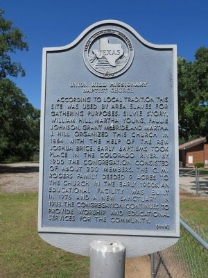
Union Hill Missionary Baptist Church
Erected 1995 by Texas Historical Commission. (Marker Number 9235.)
Topics. This historical marker is listed in these topic lists: African Americans • Churches & Religion • Settlements & Settlers. A significant historical year for this entry is 1864.
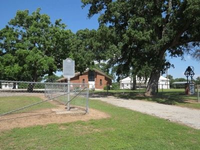
Location. 30° 11.308′ N, 97° 25.292′ W. Marker is near Bastrop, Texas, in Bastrop County. Marker is on Farm to Market Road 969, 0.4 miles north of Farm to Market Road 61, on the left when traveling west. Touch for map. Marker is at or near this postal address: 1430 FM 969, Bastrop TX 78602, United States of America. Touch for directions.
Other nearby markers. At least 8 other markers are within 6 miles of this marker, measured as the crow flies. Wilbarger's Bend (approx. 0.9 miles away); Bluff Trail Overlook (approx. 3.3 miles away); Site of the Home of Col. Robert M. Coleman (approx. 3.6 miles away); George Self (approx. 5 miles away); Joseph J. Manor Cemetery (approx. 5 miles away); David Crawford Edmiston (approx. 5 miles away); James Euwin Edmiston (approx. 5 miles away); Kings Highway Camino Real — Old San Antonio Road (approx. 5˝ miles away). Touch for a list and map of all markers in Bastrop.
Credits. This page was last revised on December 4, 2021. It was originally submitted on April 22, 2015, by Richard Denney of Austin, Texas. This page has been viewed 524 times since then and 33 times this year. Photos: 1, 2. submitted on April 22, 2015, by Richard Denney of Austin, Texas. • Bernard Fisher was the editor who published this page.

