West Haverstraw in Rockland County, New York — The American Northeast (Mid-Atlantic)
Col. A. H. Hay

Photographed By Bill Coughlin, June 7, 2008
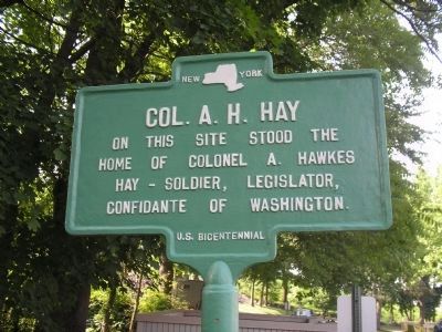
1. Col. A. H. Hay Marker
Colonel Ann Hawkes Hay led a Regiment during the Revolutionary War. His house suffered at the hands of the British. In a letter written from West Point on August 2, 1779, Gen. Washington expressed his distress to Hay about the "repeated depredations of the enemy on your property".
On this site stood the home of Colonel A. Hawkes Hay – Soldier, Legislator, Confidante of Washington
Erected 1976 by State of New York.
Topics. This historical marker is listed in these topic lists: Settlements & Settlers • War, US Revolutionary.
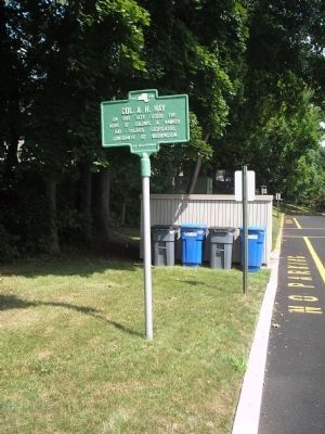
Location. 41° 12.866′ N, 73° 59.147′ W. Marker is in West Haverstraw, New York, in Rockland County. Marker can be reached from S Liberty Drive (U.S. 9W), on the right when traveling north. Marker is within a Senior Housing Community on Route 9W. Touch for map. Marker is in this post office area: West Haverstraw NY 10993, United States of America. Touch for directions.
Other nearby markers. At least 8 other markers are within walking distance of this marker. Treason House (approx. ¼ mile away); Washington Tree (approx. ¼ mile away); Calico Hill (approx. 0.4 miles away); Stony Point 9-11 Memorial (approx. 0.8 miles away); Stony Point Cannon Memorial (approx. 0.8 miles away); Stony Point Veterans Monument (approx. 0.8 miles away); a different marker also named Stony Point Veterans Monument (approx. 0.8 miles away); James A. Farley Memorial Bridge (approx. 0.9 miles away).
Credits. This page was last revised on January 28, 2021. It was originally submitted on June 9, 2008, by Bill Coughlin of Woodland Park, New Jersey. This page has been viewed 2,274 times since then and 57 times this year. Last updated on January 26, 2021, by Carl Gordon Moore Jr. of North East, Maryland. Photos: 1. submitted on June 9, 2008, by Bill Coughlin of Woodland Park, New Jersey. 2. submitted on July 18, 2010, by Bill Coughlin of Woodland Park, New Jersey. 3. submitted on June 9, 2008, by Bill Coughlin of Woodland Park, New Jersey. • J. Makali Bruton was the editor who published this page.

