Napier Township near Schellsburg in Bedford County, Pennsylvania — The American Northeast (Mid-Atlantic)
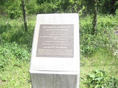
Bedford Co. Bridge #15
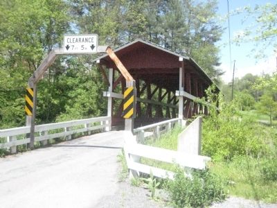
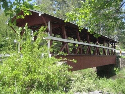
Colvin Covered Bridge
Rehabilitated in 1996
Co. Commissioners: Norma C. Ickes, Chairperson; Dick M. Rice; Gary W. Ebersole
Co. Engineer: P. Joseph Lehman, Inc.
Contractor: Kee Ta Qyah Construction
History of the Bridge
Constructed around 1880, the Colvin Covered Bridge is one of Bedford County's oldest remaining covered bridges. The original builder of this structure which spans the Shawnee Creek was J. H. Thompson. This bridge is one of only two multiple king post covered bridges in the county.
Topics and series. This historical marker is listed in this topic list: Bridges & Viaducts. In addition, it is included in the Covered Bridges series list. A significant historical year for this entry is 1996.
Location. 40° 2.274′ N, 78° 39.267′ W. Marker is near Schellsburg, Pennsylvania, in Bedford County. It is in Napier Township. Marker is on Mill Road, 0.9 miles Lincoln Highway (U.S. 30), on the left when traveling south. Touch for map. Marker is in this post office area: Schellsburg PA 15559, United States of America. Touch for directions.
Other nearby markers. At least 8 other markers are within 2 miles of this marker, measured as the crow flies. 1806 Old Log Church (approx. 0.6 miles away); Old Log Church (approx. 0.8 miles away); Forbes Camp (approx. 0.8 miles away); Shawnee Cabins (approx. 0.8 miles away); Forbes Road (approx. 0.8 miles away); Lincoln Highway Heritage Corridor (approx. 0.9 miles away); The Beginning of Agricultural Cooperative Extension Service (approx. 0.9 miles away); Veterans Memorial (approx. 1.2 miles away). Touch for a list and map of all markers in Schellsburg.
Also see . . . Bedford County's webpage for the Colvin Covered Bridge. Has a photo of the bridge prior to restoration. (Submitted on June 11, 2008, by F. Robby of Baltimore, Maryland.)
Credits. This page was last revised on January 26, 2024. It was originally submitted on June 11, 2008, by F. Robby of Baltimore, Maryland. This page has been viewed 1,516 times since then and 36 times this year. Photos: 1, 2, 3. submitted on June 11, 2008, by F. Robby of Baltimore, Maryland.


