Johnson City in Washington County, Tennessee — The American South (East South Central)
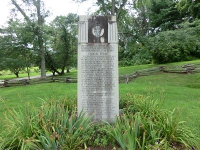
Tennessee Early History Monument
(Side one)
Colonial Period
The first men of the English speaking race to tread the soil of Tennessee, James Needham and Gabriel Arthur, passed this site in June, 1673. They followed a great buffalo trail. Crossing the Alleghenies through a low gap, they followed the Watauga River until they reached Buffalo Creek, then up that creek the trail led toward the base of Buffalo Mountain and the waters of the Nolachucky, then to the Indian towns on Little Tennessee River. They were sent out to seek a trade with the Cherokee Indians by Col. Abraham Wood from his trading post (site of present Petersburg, Va.). Needham returned to report to Wood, then began a second journey to the west, but was killed by an Indian guide. Col. Wood wrote of him to a representative of an English nobleman “soe died this heroic Englishman whose fame shall never die if my penn were able to eternize it.”
In this spirit this monument was erected, 1946, the Sesquicentennial year of Tennessee’s statehood.
Daniel Boone in the 1760’s, followed the same buffalo trail, and passed this site. Near the bold spring on the premises he erected a rude hunting camp, then passed around Buffalo Mountain and hunted on a nearby creek which ever afterward bore his name - Boone’s Creek - a favorite hunting ground. It was at its mouth that Boone’s friend, Wm. Beam established the first permanent white settlement in Tennessee 1768-9. Contributed to by the National Society of Colonial Dames in Tennessee.
(Side two)
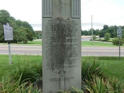
Period of 1791-1815
Jacob Tipton, son of Col. John, at the head of a company, raised in this vicinity, as a part of the Battalion of Major Matthew Rhea, marched under call of Brig. Gen. John Sevier from near this place through Cumberland Gap, across the Ohio on to the western Ohio country, and fought at St. Clair’s defeat, 1791, against the Indians of the Northwest Territory.
Capt. Tipton in a gallant counterattack was killed, as were many of his officers and men.
Tipton County in West Tennessee proudly bears the name of the brave Captain.
John Tipton, Jr. a younger brother, was under General Jackson in the battle of New Orleans, 1815. Later he was a Colonel of Militia and served in several sessions of the Tennessee Legislatures. When in that body in 1829 as State Senator, he was elected Speaker (Potential Governor).
He died early in the session: was given a State Funeral and buried in the Old City Cemetery, Nashville. The state erected a monument at his grave.
His home at the time was in the residence on this site.
Erected 1946 by Tennessee Historical Commission, and other Patriotic Societes.
Topics. This historical marker and monument is listed in this topic list: Settlements & Settlers. A significant historical month for this entry is June 1673.
Location. 36° 17.733′ N, 82° 19.917′ W. Marker is in Johnson City, Tennessee, in Washington County. Marker is on South Roan Street south of Bonita Drive, on the right when traveling south. This marker is near the entrance to the Tipton-Haynes Historic Site. Touch for map. Marker is in this post office area: Johnson City TN 37601, United States of America. Touch for directions.
Other nearby markers. At least 8 other markers are within 2 miles of this marker, measured as the crow flies. Andre Michaux (here, next to this marker); Tipton-Haynes Historic Site (here, next to this marker); Landon Carter Haynes (about 500 feet away, measured in a direct line); First English-Speaking Visitors (about 700 feet away); Tipton-Haynes Cemetery (approx. ¼ mile away); First Court of Washington County (approx. 0.9 miles away); Passenger Service (approx. 1.1 miles away); A Narrow-Gauge Railroad (approx. 1.1 miles away). Touch for a list and map of all markers in Johnson City.
Credits. This page was last revised on January 20, 2020. It was originally submitted on October 23, 2013, by Don Morfe of Baltimore, Maryland. This page has been viewed 559 times since then and 33 times this year. Last updated on May 10, 2015, by J. Makali Bruton of Accra, Ghana. Photos: 1, 2. submitted on October 23, 2013, by Don Morfe of Baltimore, Maryland. • Bill Pfingsten was the editor who published this page.

