Saint Andrews, Manitoba — Canada’s Prairie Region (North America)
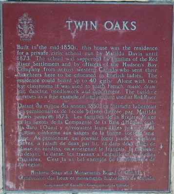
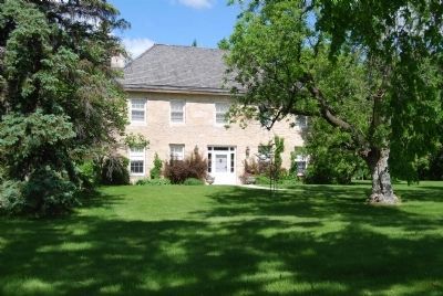
Twin Oaks
Datant du milieu des années 1850, ce bâtiment hébergeait les pensionnaires de l’école privée par Matilda Davis jusqu’en 1873. Les familles de la Rivière Rouge et les agents de la Compagnie de la Baie d’Hudson établis dans l’Ouest y envoyaient leurs filles pour une éducation conforme aux usages de la bonne société anglaise. Au pensionnat, qui pouvait loger jusqu’à quarante élèves, à raison de deux par lit, et dans deux salles de classe en rondins, on enseignait le français, la musique, le dessin, la danse, les travauvaux à l’aiguille et les bonnes manières. C’est là un bel exemple de l’architecture de la région.
Erected 1984 by Government of Canada.
Topics and series. This historical marker is listed in these topic lists: Education • Notable Buildings • Settlements & Settlers. In addition, it is included in the Canada, Historic Sites and Monuments Board series list. A significant historical year for this entry is 1873.
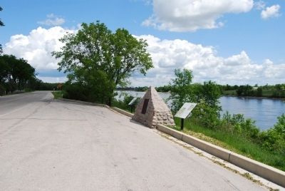
Location. 50° 3.332′ N, 96° 59.261′ W. Marker is in Saint Andrews, Manitoba. Marker is on River Road (Provincial Highway 238), on the right when traveling north. Touch for map. Marker is at or near this postal address: 292 River Road, Saint Andrews MB R1A 2X2, Canada. Touch for directions.
Other nearby markers. At least 8 other markers are within 21 kilometers of this marker, measured as the crow flies. St. Andrew’s Rectory (approx. 1.4 kilometers away); St. Andrews Anglican Church (approx. 1.4 kilometers away); St. Andrews Caméré Curtain Dam (approx. 4.4 kilometers away); Nicolaus Copernicus / Mikołaj Kopernik (approx. 20.3 kilometers away); Commemorating Manitoba Theatre Centre's 50th Anniversary (approx. 20.5 kilometers away); St. Boniface / Saint-Boniface (approx. 20.5 kilometers away); First Salvation Army Meeting West of the Great Lakes (approx. 20.5 kilometers away); The Royal Manitoba Theatre Centre (approx. 20.5 kilometers away). Touch for a list and map of all markers in Saint Andrews.
Credits. This page was last revised on January 23, 2022. It was originally submitted on June 20, 2008, by Dawn Bowen of Fredericksburg, Virginia. This page has been viewed 3,250 times since then and 57 times this year. Photos: 1, 2, 3. submitted on June 20, 2008, by Dawn Bowen of Fredericksburg, Virginia. • J. J. Prats was the editor who published this page.


