Grahamville in Horry County, South Carolina — The American South (South Atlantic)
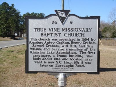
True Vine Missionary Baptist Church
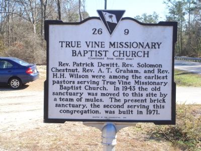
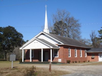
Rev. Patrick Dewitt, Rev. Solomon Chestnut, Rev. A. T. Graham, and Rev. H. H. Wilson were among the earliest pastors serving True Vine Missionary Baptist Church. In 1943 the old sanctuary was moved to this site by a team of mules. the present brick sanctuary, the second serving the congregation, was built in 1971.
Erected 1999 by the congregation. (Marker Number 26-9.)
Topics. This historical marker is listed in this topic list: Churches & Religion. A significant historical year for this entry is 1894.
Location. 33° 49.317′ N, 78° 54.367′ W. Marker is in Grahamville, South Carolina, in Horry County. Marker is on State Highway 90 west of Conway Bypass (State Highway 22), on the right when traveling west. It is between U.S. Route 501 and South Carolina 22. Touch for map. Marker is in this post office area: Conway SC 29526, United States of America. Touch for directions.
Other nearby markers. At least 8 other markers are within 9 miles of this marker, measured as the crow flies. Coastal Carolina University (approx. 6.3 miles away); Morris Island Lighthouse (approx. 7.6 miles away); Kingston Church (approx. 8 miles away); Old Horry County Courthouse (approx. 8.1 miles away); High Water Mark Hurricane Florence (approx. 8.1 miles away); Woodward Building (approx. 8.1 miles away); The Historic Brick for this Park (approx. 8.1 miles away); Welcome to Kingston Park! (approx. 8.1 miles away).
Credits. This page was last revised on January 31, 2021. It was originally submitted on February 6, 2007, by J. J. Prats of Powell, Ohio. This page has been viewed 1,901 times since then and 29 times this year. Photos: 1, 2, 3. submitted on February 6, 2007, by J. J. Prats of Powell, Ohio.


