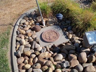
Sutter Creek in Amador County, California — The American West (Pacific Coastal)
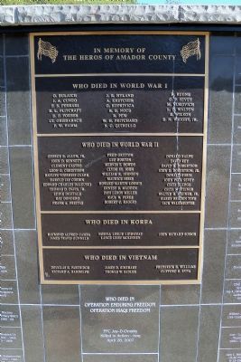
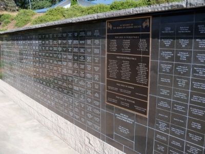
In Memory of the Heros of Amador County
G. Bulaich J.A. Cuneo F.S. Ferrari B.L Flitcraft B.F. Forbes LT. Griesabach P.W. Hamm J.R. Hyland A. Kretcher G. Koprivica R.E. Noce R. Pew W.H. Pritchard S.C. Quirollo R. Rugne C.P. Sevey M. Vukovich L.E. Walton E. Wilson E.N. Wright, Jr.
Who Died in World War II
George E. Allen, Jr. John D. Bennett Clement Castro Leon G. Christison Baylies Voorheis Clark Harold Jay Corbin Edward Charles Daleuski Thomas D. Davis, Jr. Eddie Digitale Ray Dondero Frank A. Freitas Fred Gritton Leo Horton Mervin T. Howdy Clyde St. John William R. Johnson Maurice Joses Howard Martin Loomis Ernest E. Madden Don Leroy Miller Raul N. Perez Robert C. Raggio Donald Ralph David Rey David H. Robertson John D. Robertson, Jr. Donald Robin John Paul Sevey Cecil Sledge Cecil S. Steiner Walter H. Steiner, Jr. Harry Braden Toye Jack Walkmeister
Who Died in Korea
Raymond Alfred Gamba James Travis Gunnels Norval Leslie Liddicoat Lance Leon McKinney John Richard Susich
Who Died in Vietnam
Douglas E. Partridge Richard A. Randolph James D. Rinehart Thomas W. Sadler Frederick H. Williams Clifford E. Spiva
Who Died in Operation Enduring Freedom
and Operation Iraqi Freedom
PFC Jay-D Ornsby
Killed in Action - Iraq
April 28, 2007
Erected by American Legion Post 108.
Topics. This memorial is listed in these topic lists: War, 1st Iraq & Desert Storm • War, Vietnam • War, World I • War, World II.
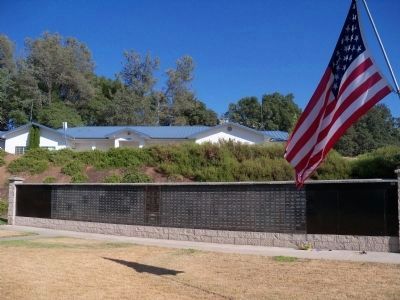
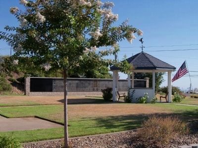
Location. 38° 22.506′ N, 120° 48.049′ W. Marker is in Sutter Creek, California, in Amador County. Memorial is at the intersection of Airport Road and Golden Chain Highway (California Route 49), on the left when traveling west on Airport Road. The American Legion post is at the corner of Airport Road and Hwy 49. The marker/memorial is in back (south of) of the building along Hwy 49. Touch for map. Marker is at or near this postal address: 12134 Airport Rd, Sutter Creek CA 95685, United States of America. Touch for directions.
Other nearby markers. At least 8 other markers are within walking distance of this marker. 1854 · Amador County · 1954 (approx. half a mile away); Botto Saloon (approx. half a mile away); Central Eureka Mine (approx. half a mile away); Amador Ledger (approx. 0.9 miles away); Old Eureka Mine (approx. one mile away); a different marker also named Old Eureka Mine (approx. one mile away); Knight Scarifier The Scarifier that will scarify (approx. one mile away); Miners' Bend Park (approx. one mile away). Touch for a list and map of all markers in Sutter Creek.
Credits. This page was last revised on June 16, 2016. It was originally submitted on July 16, 2015, by James King of San Miguel, California. This page has been viewed 658 times since then and 25 times this year. Last updated on July 17, 2015, by James King of San Miguel, California. Photos: 1, 2, 3. submitted on July 16, 2015, by James King of San Miguel, California. 4, 5. submitted on July 17, 2015, by James King of San Miguel, California. • Andrew Ruppenstein was the editor who published this page.
