Jefferson in Jefferson Parish, Louisiana — The American South (West South Central)
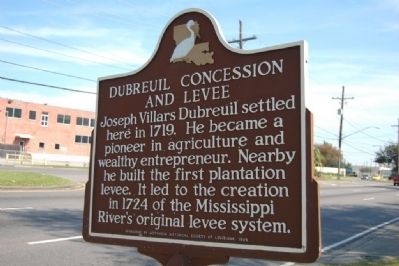
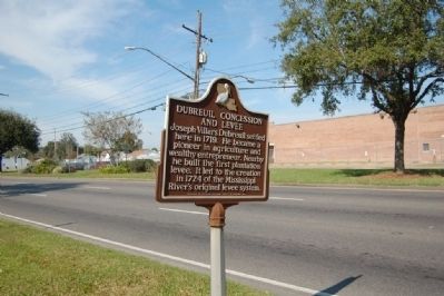
Dubreuil Concession and Levee
Erected 1984 by Jefferson Historical Commission.
Topics. This historical marker is listed in this topic list: Settlements & Settlers. A significant historical year for this entry is 1710.
Location. 29° 57.762′ N, 90° 8.728′ W. Marker is in Jefferson, Louisiana, in Jefferson Parish. Marker is on Jefferson Highway (U.S. 90) 0.1 miles east of Beltz Avenue, on the right when traveling east. Touch for map. Marker is at or near this postal address: 1516 Jefferson Hwy, New Orleans LA 70121, United States of America. Touch for directions.
Other nearby markers. At least 8 other markers are within one mile of this marker, measured as the crow flies. Jefferson Highway (approx. 0.3 miles away); Camp Parapet (approx. 0.6 miles away); a different marker also named Camp Parapet (approx. 0.7 miles away); a different marker also named Camp Parapet (approx. 0.7 miles away); Parish of Jefferson (approx. 0.8 miles away); Labarre Road (approx. 0.9 miles away); Magnolia Lane (approx. 0.9 miles away); Marsalis Mansion Motel (approx. one mile away). Touch for a list and map of all markers in Jefferson.
Credits. This page was last revised on November 20, 2023. It was originally submitted on July 25, 2015. This page has been viewed 553 times since then and 38 times this year. Photos: 1, 2. submitted on July 25, 2015. • Bernard Fisher was the editor who published this page.

