Near Pike Road in Montgomery County, Alabama — The American South (East South Central)
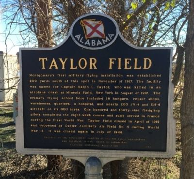
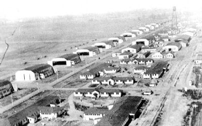
Taylor Field
Erected 1993 by The Montgomery Chapter of the Air Force Association and Founders Flight, Order of Daedalians & the Alabama Historical Association.
Topics and series. This historical marker is listed in these topic lists: Air & Space • War, World I • War, World II. In addition, it is included in the Alabama Historical Association series list. A significant historical month for this entry is April 1919.
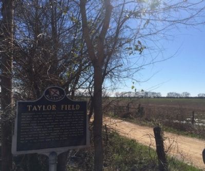
Location. 32° 18.579′ N, 86° 7.024′ W. Marker is near Pike Road, Alabama, in Montgomery County. Marker is on Ray Thorington Road (County Road 75) 0.8 miles west of Pike Road ( County Road 85), on the left when traveling west. Touch for map. Marker is at or near this postal address: 2150 Ray Thorington Road, Pike Road AL 36064, United States of America. Touch for directions.
Other nearby markers. At least 8 other markers are within 4 miles of this marker, measured as the crow flies. Pike Road School (approx. 1.9 miles away); Town of Pike Road Veterans Memorial (approx. 2.1 miles away); Ray Cemetery (approx. 2.1 miles away); Chantilly Plantation (approx. 2.6 miles away); Antioch Baptist Church (approx. 3.2 miles away); Georgia Washington School (approx. 3.2 miles away); Grace Episcopal Church (approx. 3.4 miles away); Marks House (approx. 3.6 miles away). Touch for a list and map of all markers in Pike Road.
Also see . . . Wikipedia entry on Taylor Field. (Submitted on February 27, 2014, by Mark Hilton of Montgomery, Alabama.)
Credits. This page was last revised on September 3, 2018. It was originally submitted on February 27, 2014, by Mark Hilton of Montgomery, Alabama. This page has been viewed 1,046 times since then and 78 times this year. Last updated on July 30, 2015, by J. Makali Bruton of Accra, Ghana. Photos: 1, 2, 3. submitted on February 27, 2014, by Mark Hilton of Montgomery, Alabama. • Bill Pfingsten was the editor who published this page.


