Salem in Essex County, Massachusetts — The American Northeast (New England)
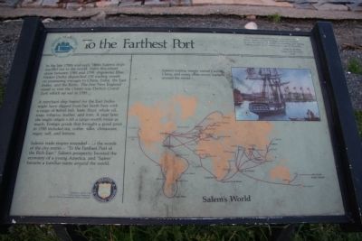
To the Farthest Port
A merchant ship bound for the East Indies might have slipped from her berth here with a cargo of salted fish, ham, flour, whale oil, soap, tobacco, leather, and iron. A year later she might return with a cargo worth twice as much. Foreign goods that brought a good price in 1790 included tea, coffee, silks, chinaware, sugar, salt, and lemons.
Salemís trade empire extended – in the words of the city motto – “To the Farthest Port of the Rich East.” Salemís prosperity boosted the economy of a young America, and “Salem” became a familiar name around the world.
Erected by U.S. Park Service.
Topics. This historical marker is listed in these topic lists: Industry & Commerce • Notable Places • Settlements & Settlers. A significant historical year for this entry is 1785.
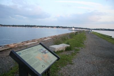
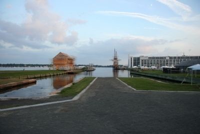
Location. Marker has been reported missing. It was located near 42° 31.08′ N, 70° 53.092′ W. Marker was in Salem, Massachusetts, in Essex County. Marker could be reached from Derby Street, 0.2 miles south of Orange Street. This historical marker is located in the Salem Maritime, National Historic Site, about 1/2 of the way out on the Derby Wharf. Touch for map. Marker was in this post office area: Salem MA 01970, United States of America. Touch for directions.
Other nearby markers. At least 8 other markers are within walking distance of this location. Friendship of Salem (approx. 0.2 miles away); a different marker also named Friendship of Salem (approx. 0.2 miles away); Pedrick Store House, 1770 (approx. 0.2 miles away); Wharves in the Early 1800s (approx. 0.2 miles away); The Point Neighborhood (approx. ľ mile away); Derby Wharf (approx. ľ mile away); Wharves in the late 1800's (approx. ľ mile away); Central Wharf (approx. ľ mile away). Touch for a list and map of all markers in Salem.
More about this marker. This marker is no longer at this location and has been replaced by another marker (Wharves in the Early 1800s).
Credits. This page was last revised on June 16, 2016. It was originally submitted on October 25, 2009, by Dale K. Benington of Toledo, Ohio. This page has been viewed 881 times since then and 10 times this year. Last updated on July 31, 2015, by J. Makali Bruton of Accra, Ghana. Photos: 1, 2, 3. submitted on October 25, 2009, by Dale K. Benington of Toledo, Ohio. • Bill Pfingsten was the editor who published this page.


