Marker Logo HMdb.org THE HISTORICAL
MARKER DATABASE
“Bite-Size Bits of Local, National, and Global History”
Niagara Falls in Niagara County, New York — The American Northeast (Mid-Atlantic)
 

The Carnegie Building

1022 Main Street

— Niagara Falls • Department of Community Development —


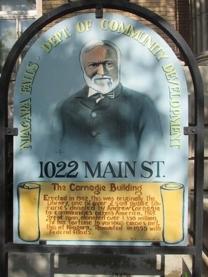
The Carnegie Building Marker image. Click for full size.
Photographed By Anton Schwarzmueller, July 10, 2015
1. The Carnegie Building Marker
Inscription. Erected in 1902, this was originally the Library, one of over 2,500 public libraries donated by Andrew Carnegie to communities across America. This great man donated over $350 million of his fortune to various causes incl. this at Niagara. Renovated in 1995 with Federal funds.
 
Erected by Pine Avenue Business Association.
 
Topics and series. This historical marker is listed in this topic list: Charity & Public Work. In addition, it is included in the Carnegie Libraries series list. A significant historical year for this entry is 1902.
 
Location. 43° 5.933′ N, 79° 3.242′ W. Marker is in Niagara Falls, New York, in Niagara County. Marker is at the intersection of Main Street (New York State Route 104) and Ashland Avenue, on the left when traveling north on Main Street. Touch for map. Marker is at or near this postal address: 1022 Main Street, Niagara Falls NY 14301, United States of America. Touch for directions.
 
Other nearby markers. At least 8 other markers are within walking distance of this marker. Gad Pierce Tavern (approx. ¼ mile away); Park Place Historic District (approx. ¼ mile away); Oakwood Cemetery (approx. ¼ mile away); In Honor of the Soldiers, Sailors & Marines (approx. 0.4 miles away); The Most Combat Decorated World War II Soldier (approx. 0.4 miles away); Niagara Falls Medal of Honor Memorial
Paid Advertisement
Click on the ad for more information.
Please report objectionable advertising to the Editor.
Click or scan to see
this page online
(approx. 0.4 miles away); Niagara Gorge Important Bird Area (approx. 0.4 miles away); Niagara Gorge Industrial Heritage (approx. 0.4 miles away). Touch for a list and map of all markers in Niagara Falls.
 
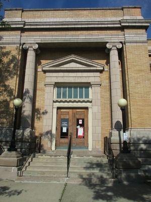
"Public Library MCMII" image. Click for full size.
Photographed By Anton Schwarzmueller, July 10, 2015
2. "Public Library MCMII"
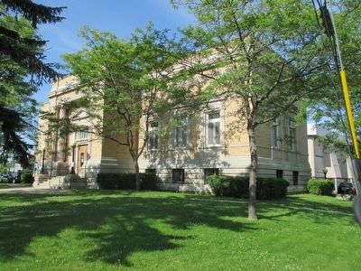
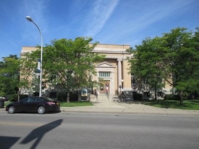
The Carnegie Building image. Click for full size.
Photographed By Anton Schwarzmueller, July 10, 2015
3. The Carnegie Building
Marker is to the left of the front entrance.
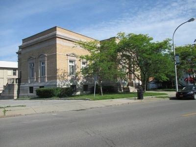
South & Front Sides image. Click for full size.
Photographed By Anton Schwarzmueller, July 10, 2015
4. South & Front Sides
Main Street, NY Route 104 is marked east-west, but is north-south in the city.
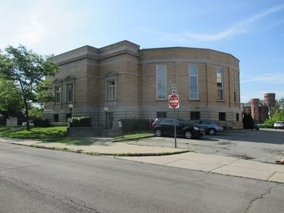
North and Rear Sides image. Click for full size.
Photographed By Anton Schwarzmueller, July 10, 2015
5. North and Rear Sides
View from Ashland Avenue.
The Carnegie Building & Marker image. Click for full size.
Photographed By Anton Schwarzmueller, July 10, 2015
6. The Carnegie Building & Marker
 
 
Credits. This page was last revised on June 16, 2016. It was originally submitted on July 31, 2015, by Anton Schwarzmueller of Wilson, New York. This page has been viewed 478 times since then and 46 times this year. Photos:   1, 2, 3, 4, 5, 6. submitted on July 31, 2015, by Anton Schwarzmueller of Wilson, New York.
Share this page.  
Share on Tumblr
m=86558

CeraNet Cloud Computing sponsors the Historical Marker Database.
This website earns income from purchases you make after using our links to Amazon.com. We appreciate your support.
Paid Advertisement
Apr. 26, 2024