Fort Laramie in Goshen County, Wyoming — The American West (Mountains)
‘Where’s the Wall?’
Fort Laramie National Historic Site
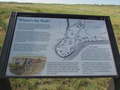
It is one of the most commonly asked questions here – and with good reason. Those who grew up watching western movies expect to see a fort with a large wooden stockade. Like many other aspects of Hollywood westerns, the walled military fort makes for better entertainment than good history.
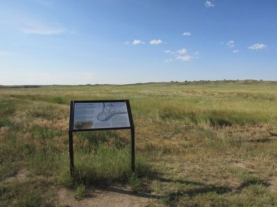
One reason Fort Laramie lacked a wall was that timber was not abundant. The other reason had to do with the combat style of the Plains Indian Warrior, who relied on mobility and preferred fighting on horseback in open terrain to siege warfare. The army quickly recognized building walled forts was unnecessary and expensive. The military did, however, construct temporary fortifications here. The linear depression in front of you is all that remains of a rifle trench built in 1865.
In February 1865, Cheyenne and Lakota warriors attacked Mud Springs Station, 105 miles east. A detachment of 172 soldiers left to relieve the station, leaving Fort Laramie dangerously undermanned. Construction of three artillery emplacements linked by rifle trenches was ordered in response.
A fortified adobe redoubt built the following year further strengthened the defenses and doubled as a corral and teamsters’ quarters. Two hexagonal blockhouses stood at opposing corners of the eight-foot-high adobe-walled enclosure. Concern about attacks subsided after the 1868 treaties were signed and the defensive trenches rapidly fell into disrepair.
Rifle Trenches
. . . works like the ones they are making are of no benefit whatever, as they will never keep Indians out of the Fort . . . . It is a well-known fact that the great danger is not in their attacking forts; but [that] they are continually on the watch for small squads, who may be out some miles from assistance . . . This is the way which Company K lost two brave and noble boys . . .
Erected by National Park Service.
Topics. This historical marker is listed in this topic list: Forts and Castles. A significant historical month for this entry is February 1865.
Location. 42° 12.396′ N, 104° 33.406′ W. Marker is in Fort Laramie, Wyoming, in Goshen County. Marker can be reached from State Highway 160, on the left when traveling west. Marker is located at Fort Laramie National Historic Site. Touch for map. Marker is in this post office area: Fort Laramie WY 82212, United States of America. Touch for directions.
Other nearby markers. At least 8 other markers are within walking distance of this marker. Noncommissioned Officers’ Quarters (within shouting distance of this marker); The Cavalry Stables (within shouting distance of this marker); The Rustic Hotel (about 400 feet away, measured in a direct line); The Post Hospital (about 500 feet away); The Rustic Hotel “ . . . No Second-Rate Affair” (about 700 feet away); Cavalry Barracks (about 800 feet away); The Sutler’s House (approx. 0.2 miles away); Fort Laramie National Historic Site (approx. 0.2 miles away). Touch for a list and map of all markers in Fort Laramie.
More about this marker. An 1867 Fort Laramie Plan of Post appears in the upper right of the marker. The locations of Rifle Trench and Artillery Emplacements, and the Fortified Adobe Corral are indicated. The bottom left features an illustration of soldiers in a rifle trench.
Also see . . . Fort Laramie National Historic Site. (Submitted on August 12, 2015, by Bill Coughlin of Woodland Park, New Jersey.)
Credits. This page was last revised on June 16, 2016. It was originally submitted on August 12, 2015, by Bill Coughlin of Woodland Park, New Jersey. This page has been viewed 386 times since then and 22 times this year. Photos: 1, 2, 3. submitted on August 12, 2015, by Bill Coughlin of Woodland Park, New Jersey.


