Old Westport in Kansas City in Jackson County, Missouri — The American Midwest (Upper Plains)
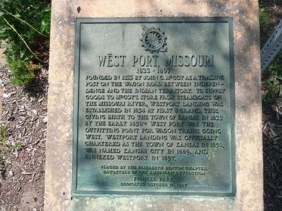
West Port, Missouri
1833 – 1897
Inscription.
Founded in 1833 by John C. McCoy as a trading post on the wagon road between Independence and the Indian Territory. To supply goods to McCoy’s store from steamboats on the Missouri River, Westport Landing was established in 1834 at First & Grand, thus giving birth to the Town of Kansas in 1839. By the early 1850s West Port was the outfitting point for wagon trains going west. Westport Landing was officially chartered as the Town of Kansas in 1850, was name Kansas City in 1889, and annexed Westport in 1897.
Placed by the Elizabeth Benton Chapter, Daughters of the American Revolution. Pioneer Park dedicated October 19 1987.
Erected 1987 by Elizabeth Benton Chapter of the Daughters of the American Revolution.
Topics and series. This historical marker is listed in this topic list: Settlements & Settlers. In addition, it is included in the Daughters of the American Revolution series list. A significant historical date for this entry is October 19, 1863.
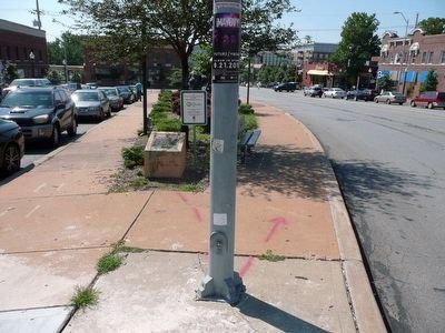
Location. 39° 3.233′ N, 94° 35.445′ W. Marker is in Kansas City, Missouri, in Jackson County. It is in Old Westport. Marker is at the intersection of Broadway Boulevard and Westport Road, in the median on Broadway Boulevard. Touch for map. Marker is in this post office area: Kansas City MO 64111, United States of America. Touch for directions.
Other nearby markers. At least 8 other markers are within walking distance of this marker. James Bridger (within shouting distance of this marker); John Calvin McCoy (within shouting distance of this marker); Alexander Majors (within shouting distance of this marker); Three Trails West (within shouting distance of this marker); Original Site of Harris House (about 400 feet away, measured in a direct line); Action Before Westport (about 400 feet away); The Albert G. Boone Store (about 400 feet away); The French and the Santa Fe Trail (about 500 feet away). Touch for a list and map of all markers in Kansas City.
Credits. This page was last revised on February 10, 2023. It was originally submitted on August 17, 2015, by Michael W. Kruse of Kansas City, Missouri. This page has been viewed 399 times since then and 32 times this year. Photos: 1, 2. submitted on August 17, 2015, by Michael W. Kruse of Kansas City, Missouri. • Bill Pfingsten was the editor who published this page.

