Downtown in Baton Rouge in East Baton Rouge Parish, Louisiana — The American South (West South Central)
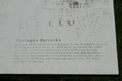
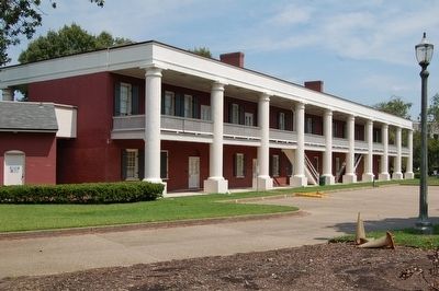
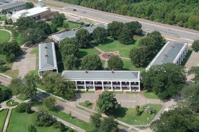
Pentagon Barracks
Topics. This historical marker is listed in this topic list: Notable Buildings. A significant historical year for this entry is 1819.
Location. 30° 27.288′ N, 91° 11.322′ W. Marker is in Baton Rouge, Louisiana, in East Baton Rouge Parish. It is in Downtown. Marker is at the intersection of North 3rd Street and Spanish Town Road, on the right when traveling south on North 3rd Street. Touch for map. Marker is in this post office area: Baton Rouge LA 70802, United States of America. Touch for directions.
Other nearby markers. At least 8 other markers are within walking distance of this marker. Bogalusa to Baton Rouge March (a few steps from this marker); The Amédé Ardoin Lemon Tree (within shouting distance of this marker); Zachary Taylor (within shouting distance of this marker); Sigma Iota (within shouting distance of this marker); Fort San Carlos (within shouting distance of this marker); Pentagon Buildings (about 300 feet away, measured in a direct line); Ole War Skule (about 300 feet away); a different marker also named Fort San Carlos (about 300 feet away). Touch for a list and map of all markers in Baton Rouge.
More about this marker. Marker is number 4 of 10 of a series of walking tour markers on the Louisiana State Capitol grounds.
Also see . . . Pentagon Barracks. National Park Servcice (Submitted on August 21, 2015.)
Credits. This page was last revised on February 12, 2023. It was originally submitted on August 21, 2015. This page has been viewed 460 times since then and 16 times this year. Photos: 1, 2, 3, 4, 5. submitted on August 21, 2015. • Bernard Fisher was the editor who published this page.


